
$39,900
About this home
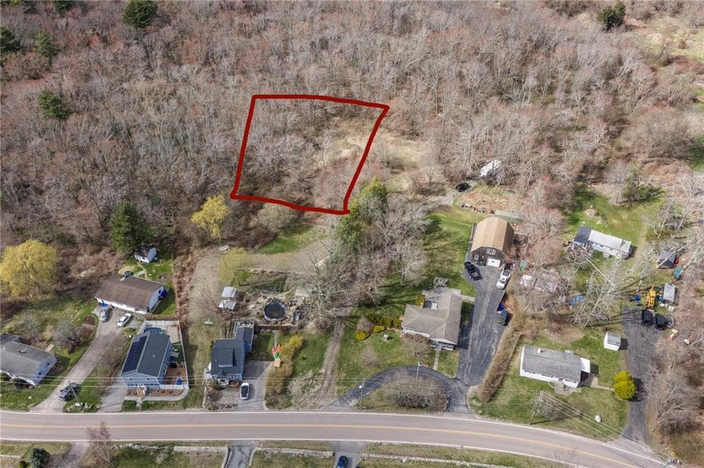
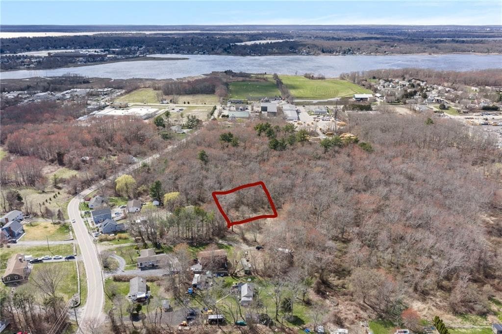
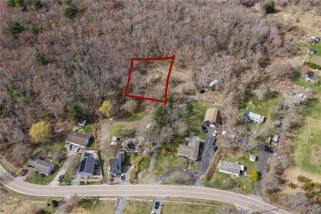
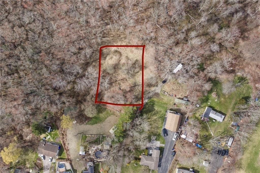
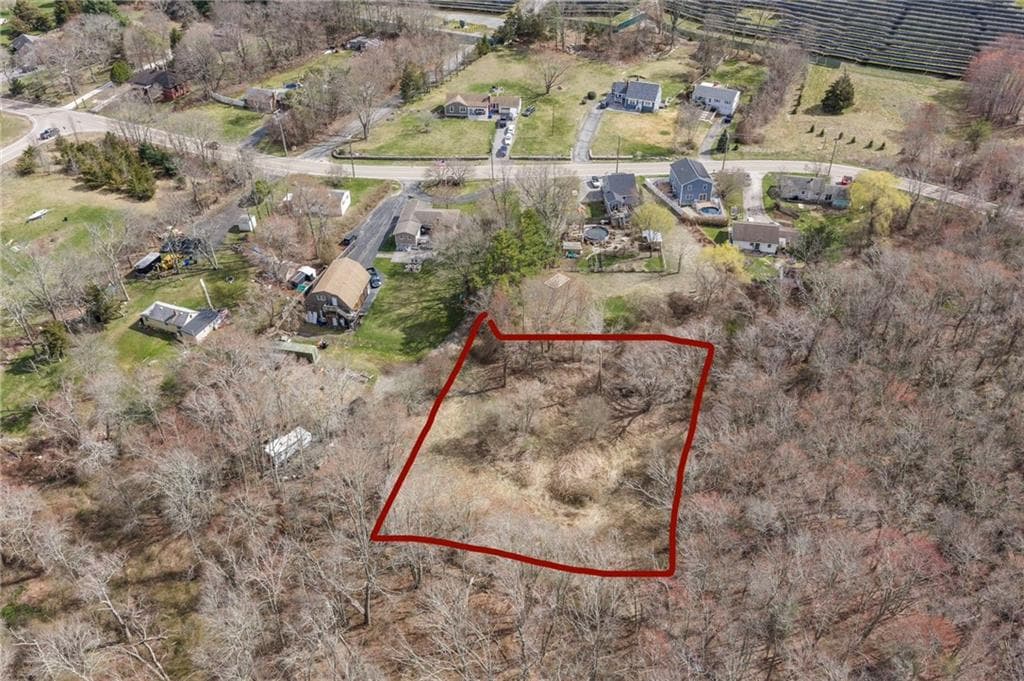
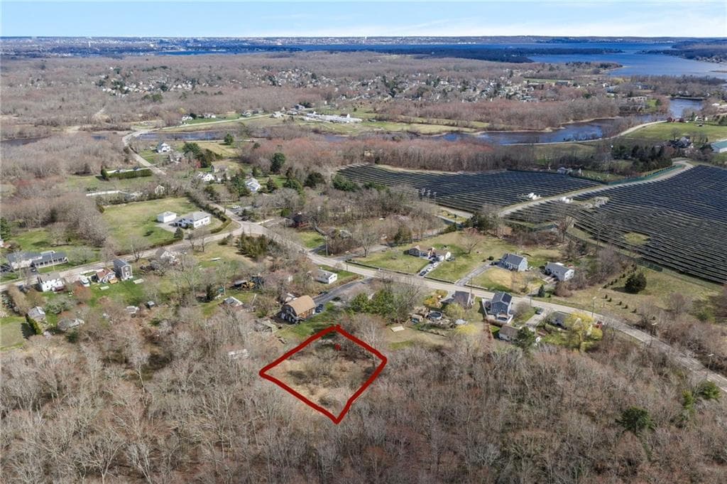
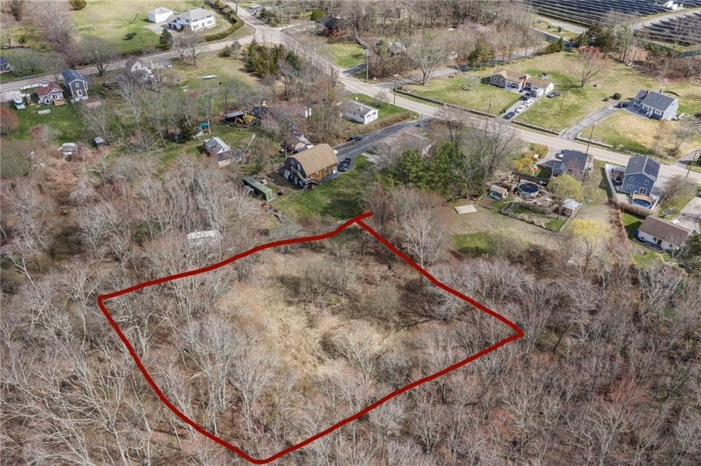
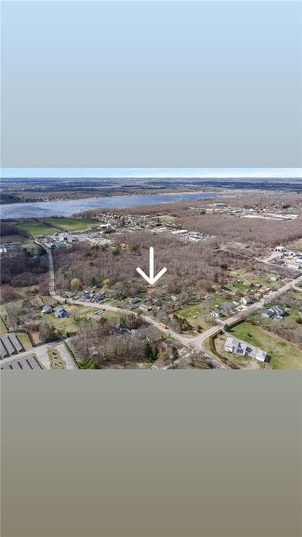
NOT CONSIDERED BUILDABLE BASED ON PRIOR SITE TESTING. Prior site evaluation identified a high seasonal water table, and the property was determined unsuitable for the buyer’s proposed septic system and residential development. This wooded .61-acre parcel contains approximately 26,572 square feet and is situated along an undeveloped paper road connecting Schoolhouse Road and Birchswamp Road in East Warren. The property may be best suited for purchase by an abutting owner seeking additional privacy or open space, conservation purposes, passive recreational use where legally permitted, or a long-term speculative hold. There is presently no established road access, and no representations are made regarding alternative uses, future development, clearing, structures, utilities or improvements. Any proposed use is subject to legal access and all applicable Town of Warren, zoning, wetlands and RIDEM requirements. Buyer must perform all due diligence. Approximate lot lines are shown for illustrative purposes only.
Property details
- MLS
- Rhode Island Association of REALTORS
- MLS #
- 1409385
- Property type
- Unimproved Land
- Subdivision
- East Warren
- Status
- Active
- Days on market
- 15
- On market date
- April 9, 2026
- Stories
- N/A
- Total bathrooms
- N/A
- Garage spaces
- N/A
- Parking spaces
- N/A
- Lot size
- 0.61 acres
Location
Get directions →Nearby schools
Within 10 miles. School directory data from the National Center for Education Statistics (NCES), accessed via the Urban Institute Education Data API. Local Score is calculated by INNOVATE Real Estate; where a state rating is shown, it comes from that state's own official school report card.
- Enrollment
- 509
- Student:teacher ratio
- 12.7:1
- District
- Bristol Warren
- Enrollment
- 684
- Student:teacher ratio
- 12.7:1
- District
- Bristol Warren
- Enrollment
- 346
- Student:teacher ratio
- 10.5:1
- District
- Highlander
Walkability
Blended score for Warren's center, calculated by INNOVATE Real Estate from two sources: the EPA's National Walkability Index (street network, transit, land-use mix) and Google Places amenity data (what's actually reachable on foot from this point). 60% EPA National Walkability Index + 40% nearby-amenity density (Google Places).
Mortgage calculator
Estimate only - actual rate and payment depend on your lender, credit, and loan program.
Adjust tax / insurance estimates
Similar homes you might like
Data source: Listing information provided by Rhode Island Association of REALTORS via Trestle/CoreLogic. Last updated 7 days ago.
Information herein deemed reliable but not guaranteed; all measurements, school assignments, HOA fees, taxes, and feature lists are approximate and should be independently verified. Equal Housing Opportunity.