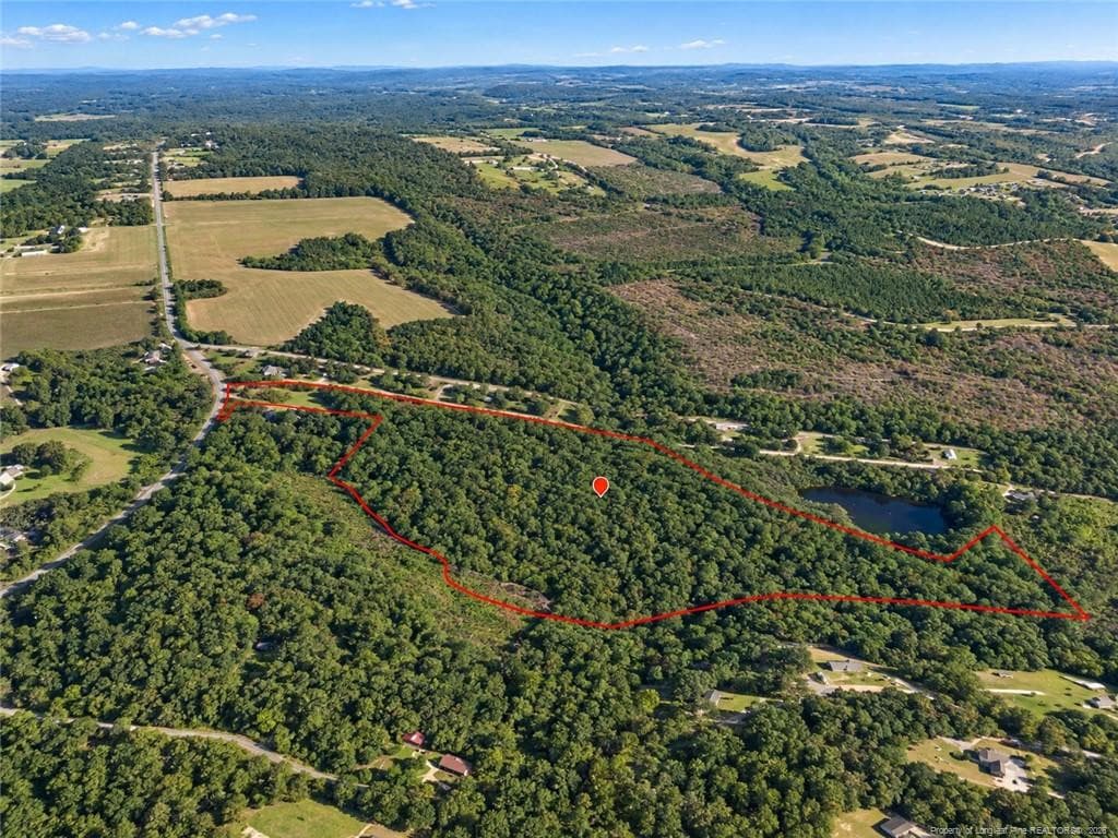
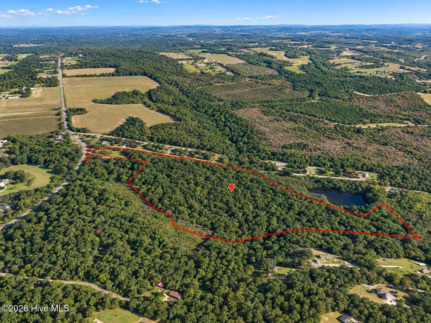
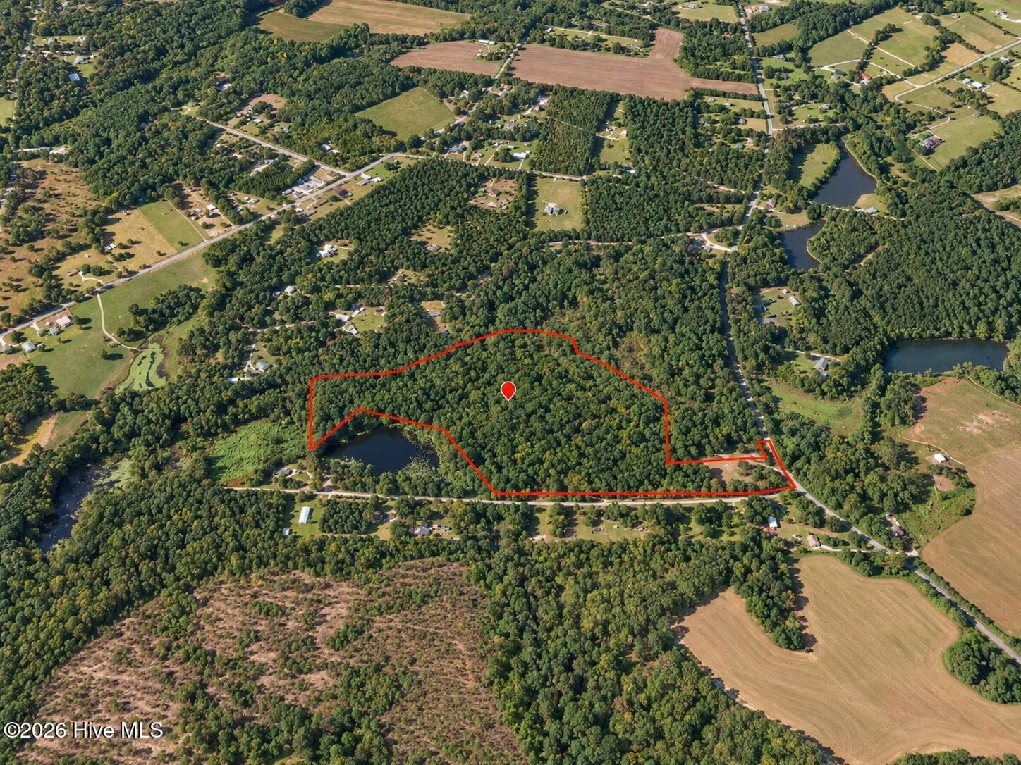
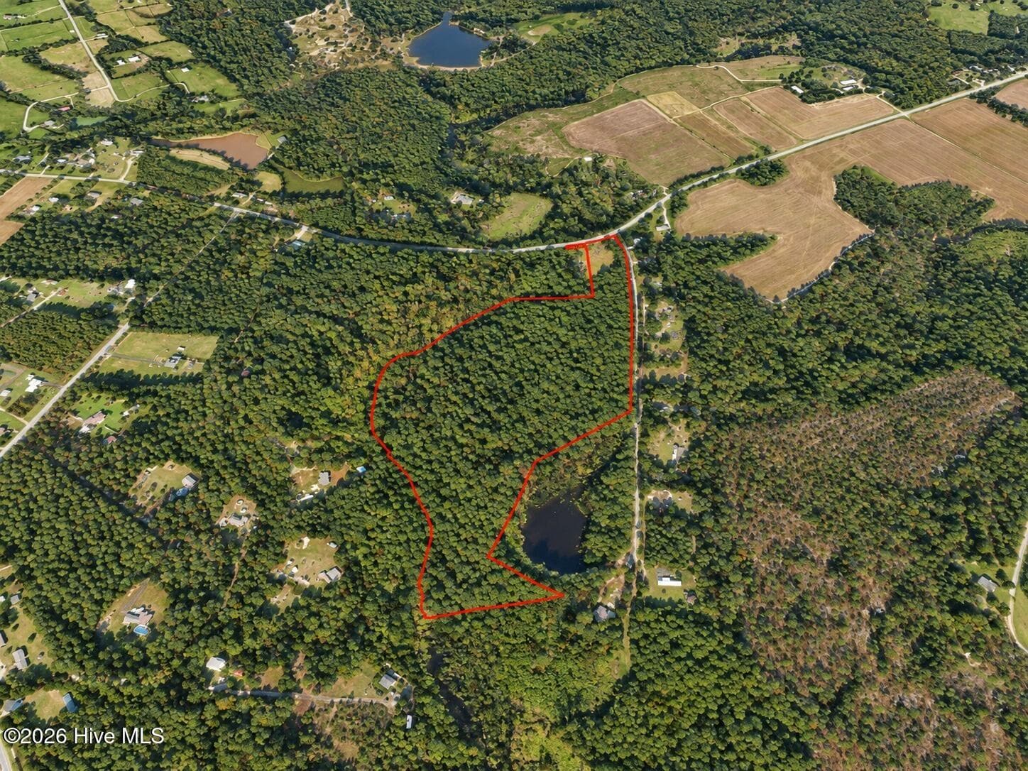
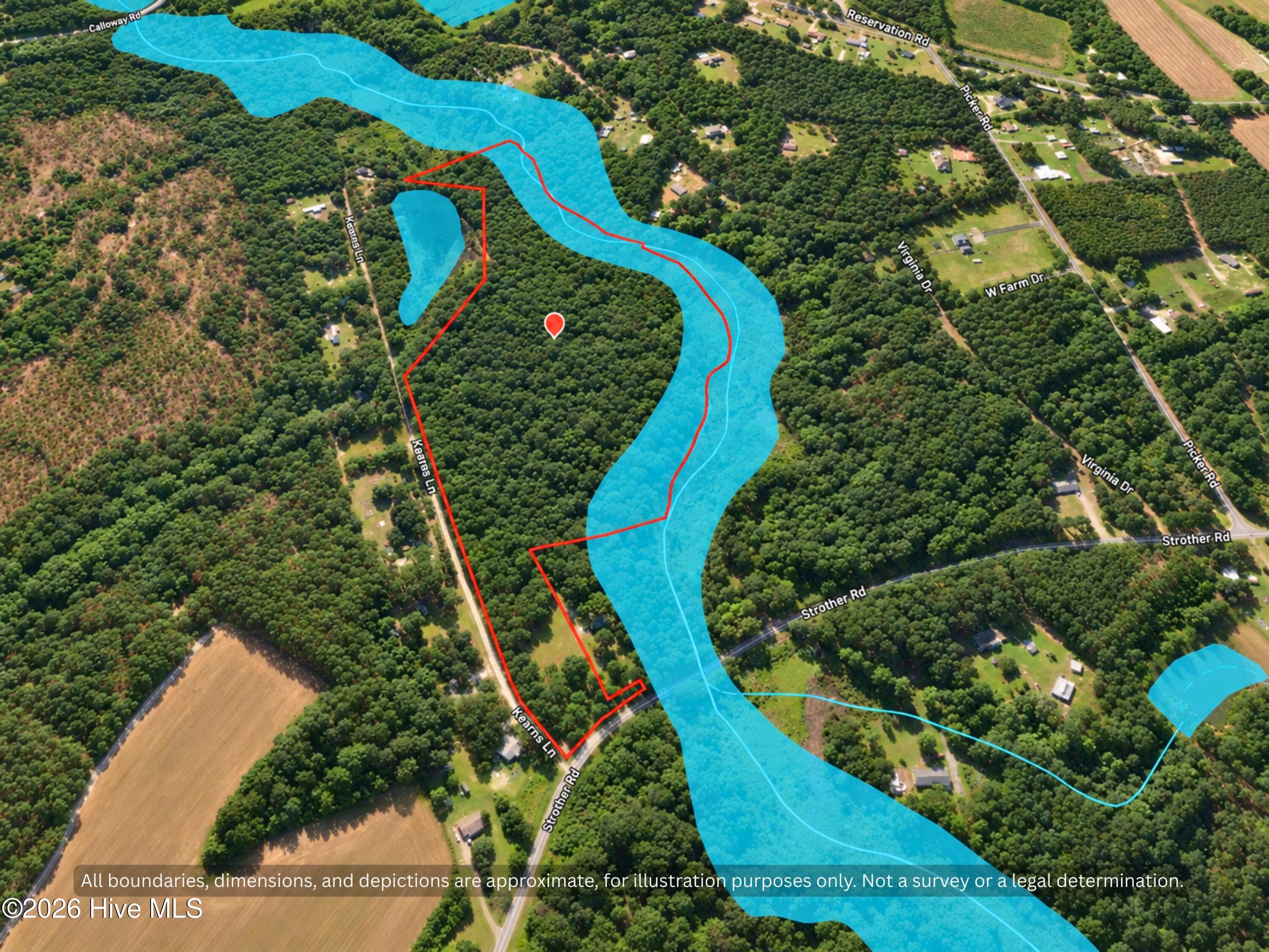
Aerial view of about 26.7 wooded acres for sale in Hoke County, NC, near Aberdeen and Raeford in the North Carolina Sandhills. Room for a country home, mini farm or homestead. Boundary approximate. Image enhanced for clarity. - 00-00 Strother Road, Aberdeen, NC 28315
26 Acres Hoke County NC - Aerial Boundary View - Aberdeen 28315 - 00-00 Strother Road, Aberdeen, NC 28315
Property Entrance - Vacant Land for Sale Aberdeen NC 28315 - 00-00 Strother Road, Aberdeen, NC 28315
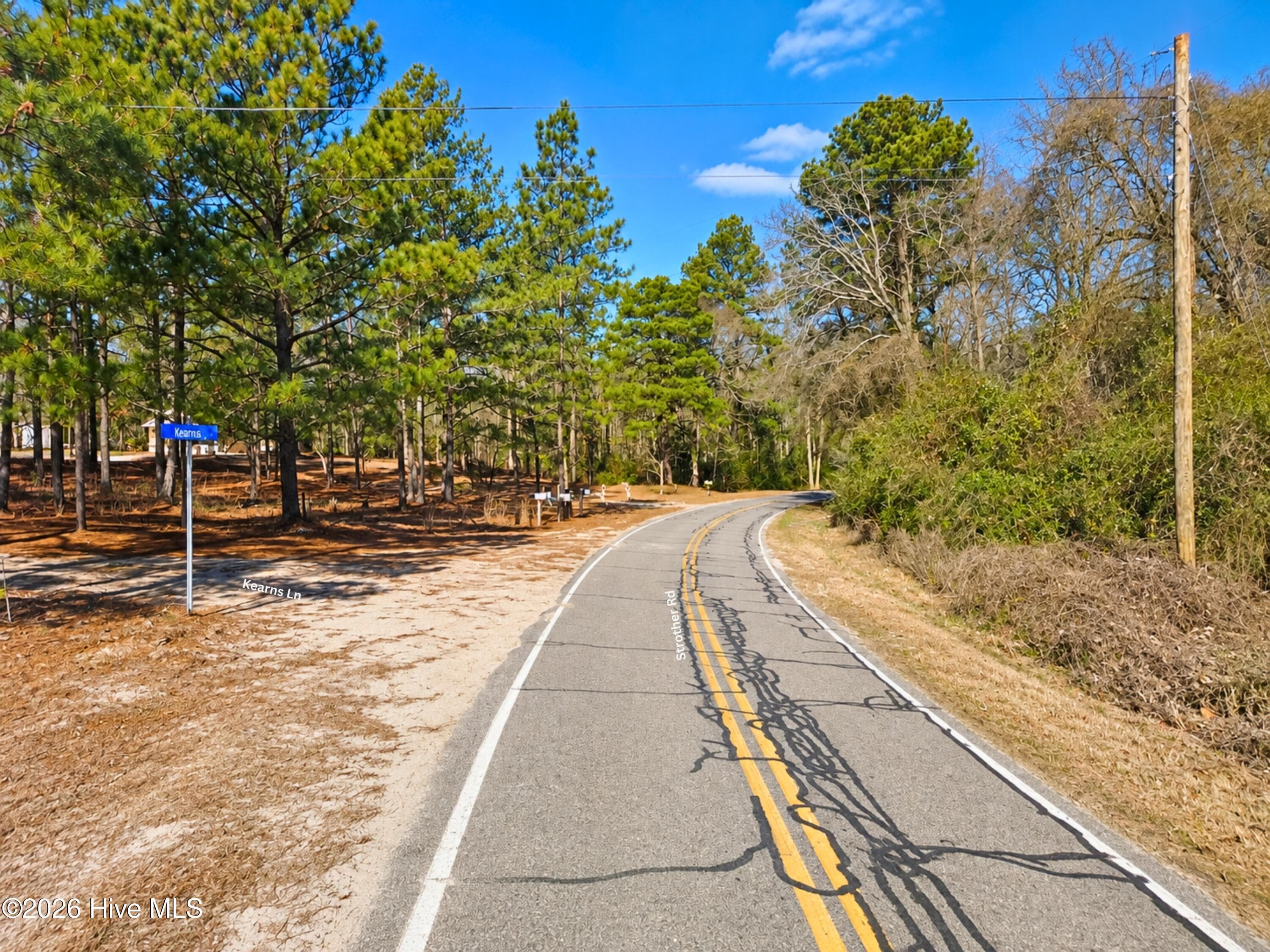
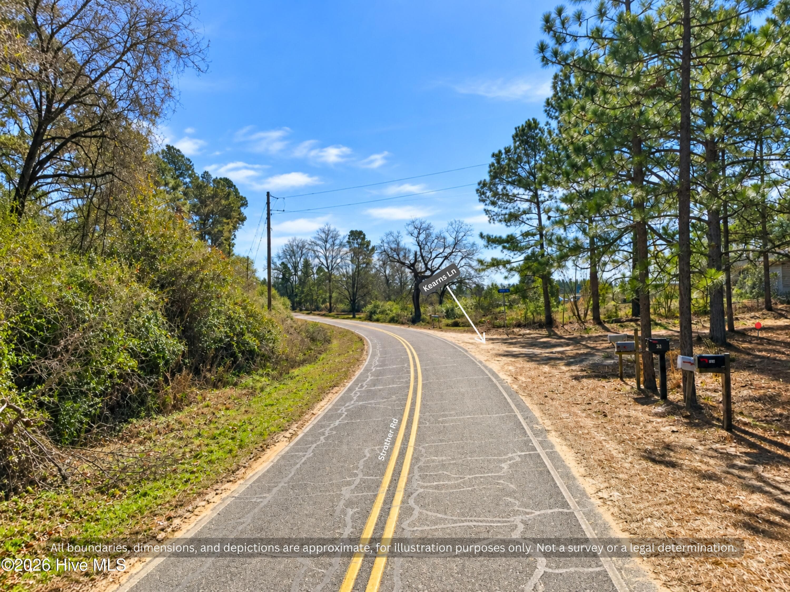
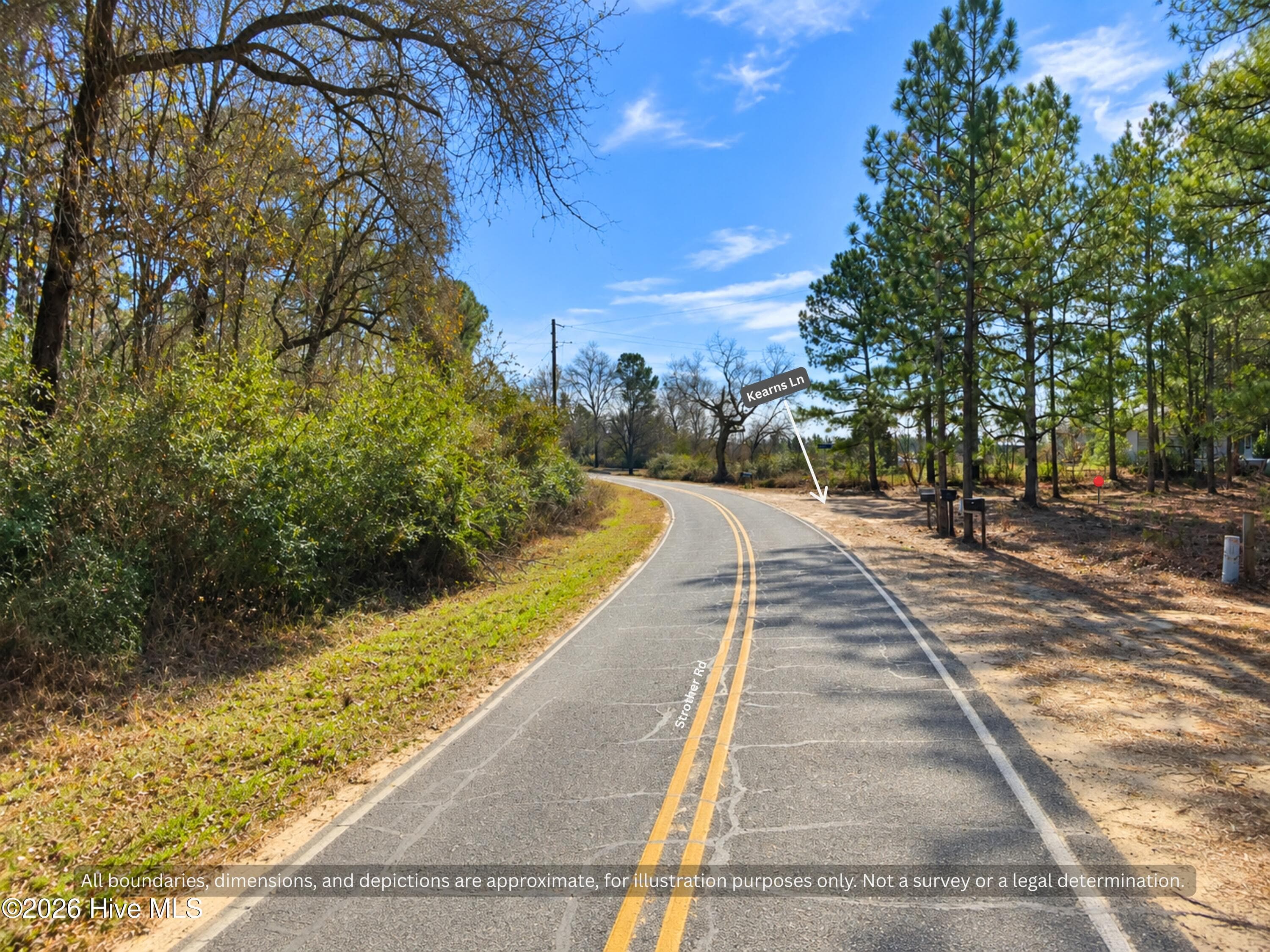
Ground view of paved, state-maintained Strother Rd where Kearns Ln meets the land. Easy year-round access to wooded Hoke County, NC acreage, with power lines along the road. - 00-00 Strother Road, Aberdeen, NC 28315
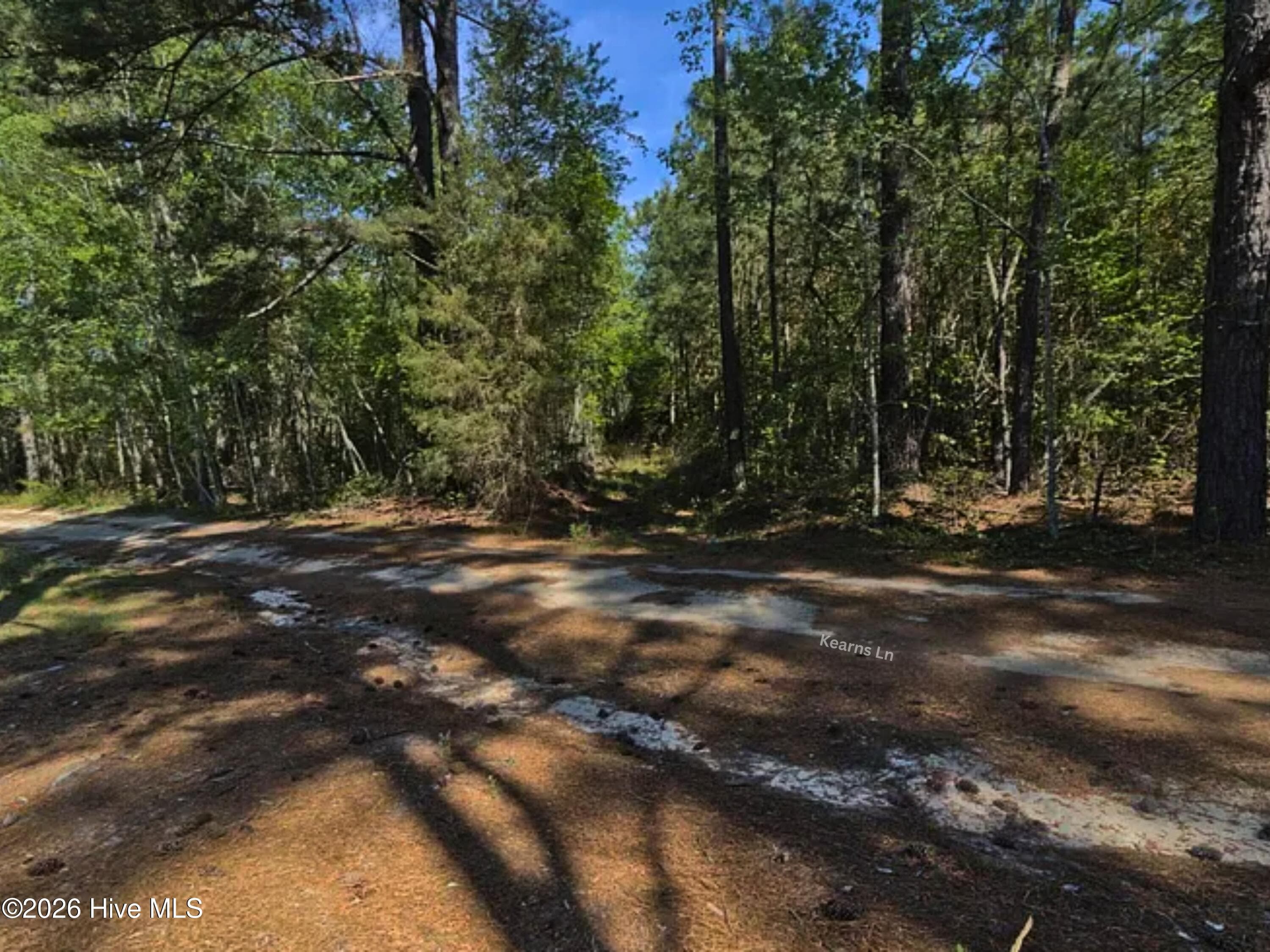
Second Road Frontage on Kearns Lane - 26 Acres Hoke County NC - 00-00 Strother Road, Aberdeen, NC 28315
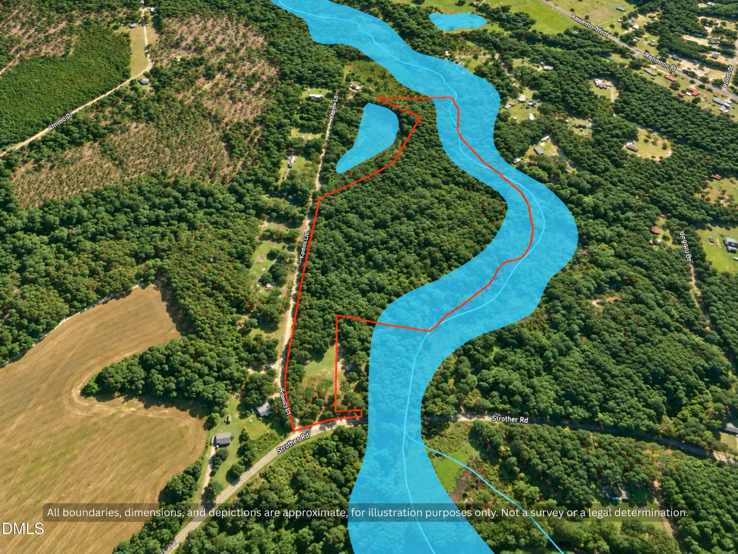
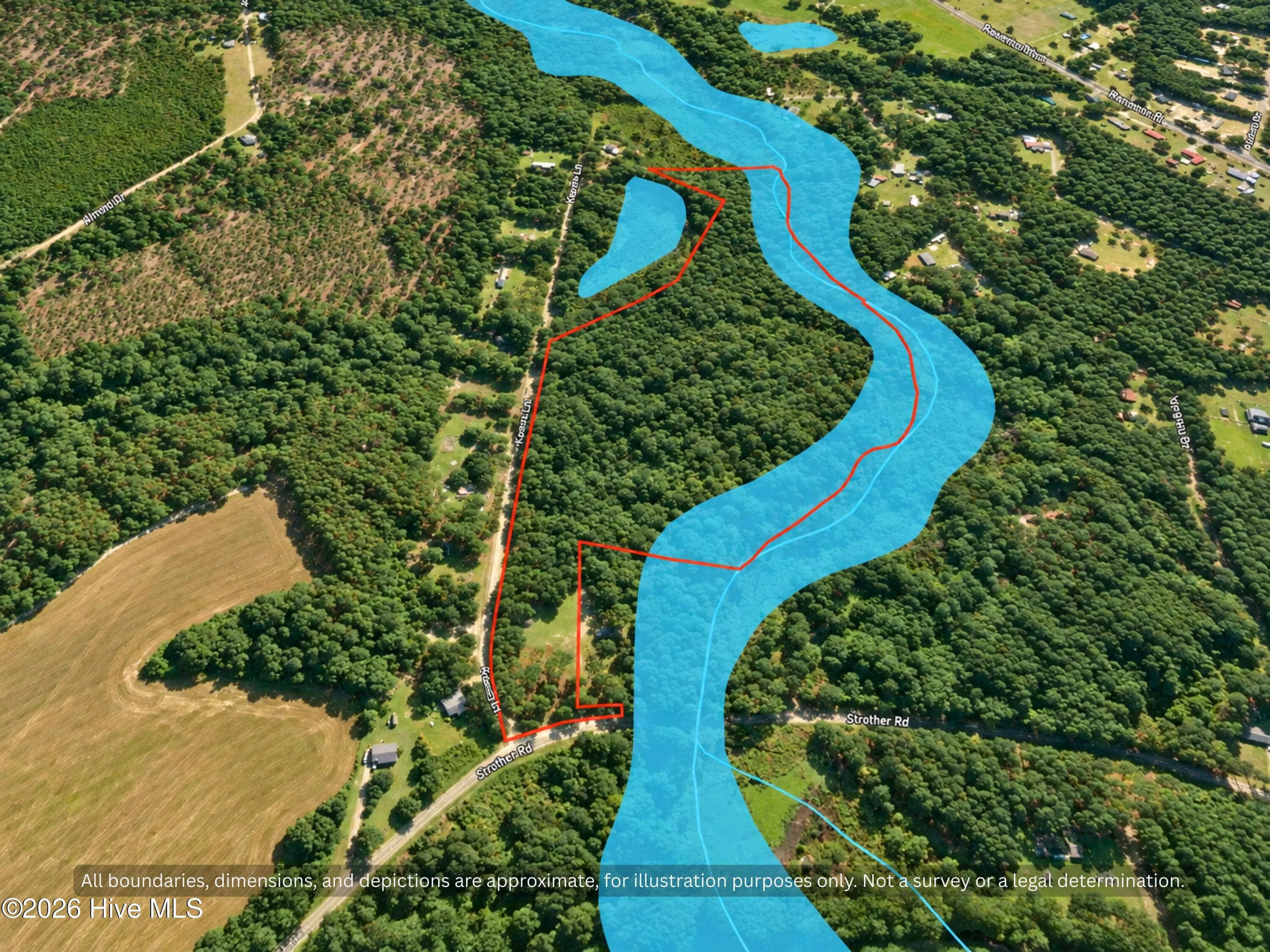
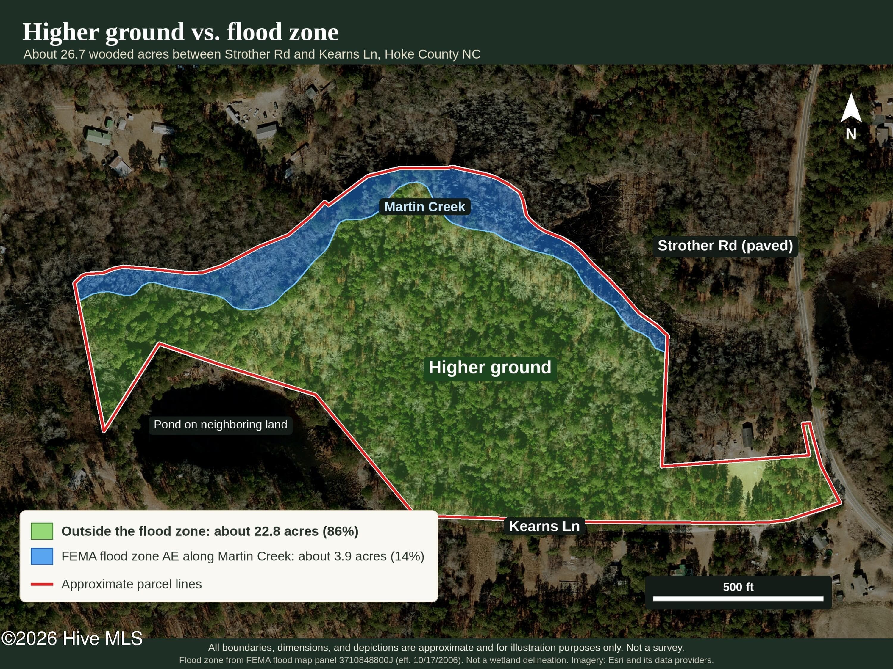
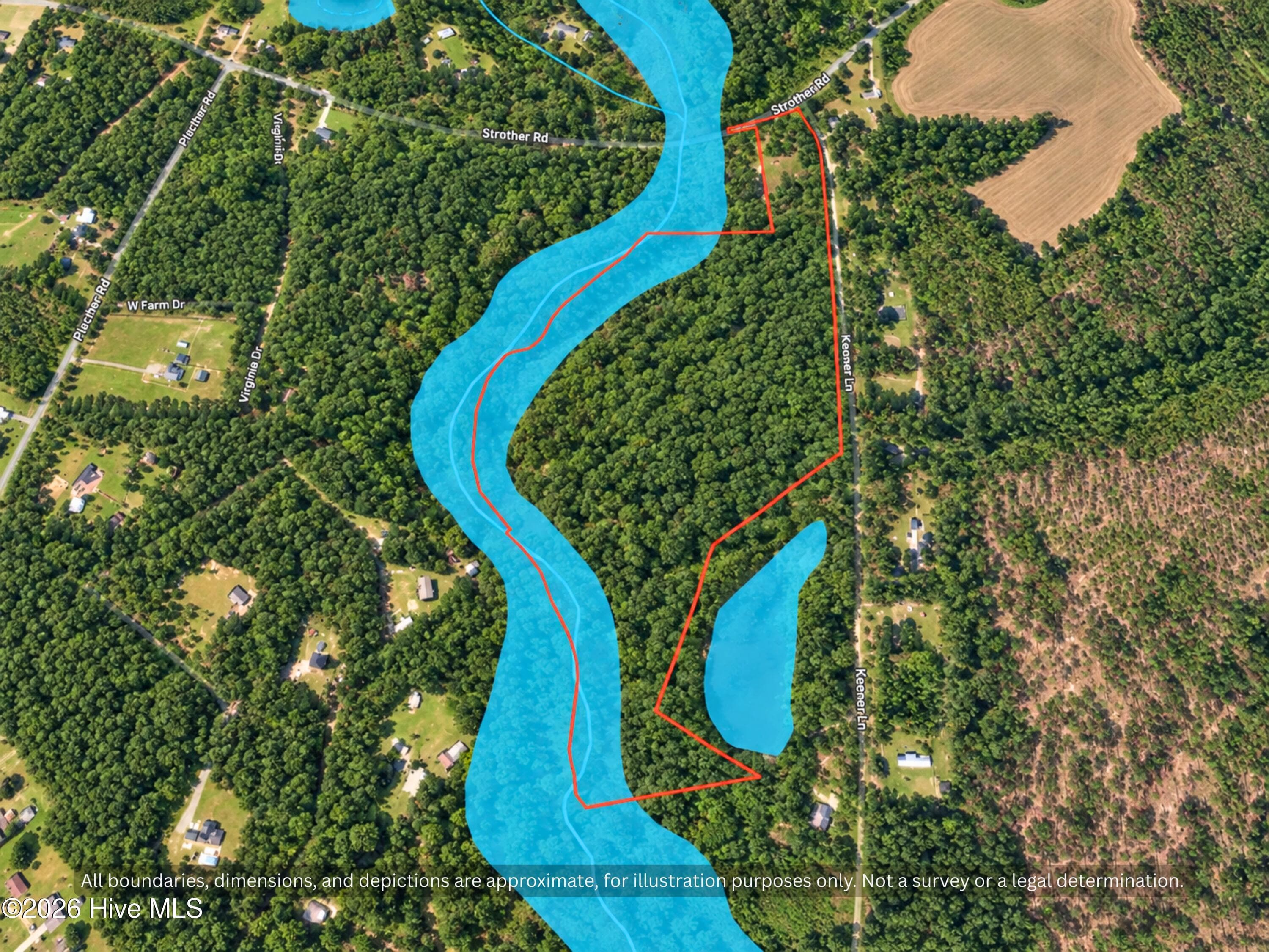
Map of the land: about 22.8 acres sit outside the FEMA flood zone, with about 3.9 acres of flood zone AE along Martin Creek on the back line. Approximate lines from county GIS and FEMA; not a survey. - 00-00 Strother Road, Aberdeen, NC 28315
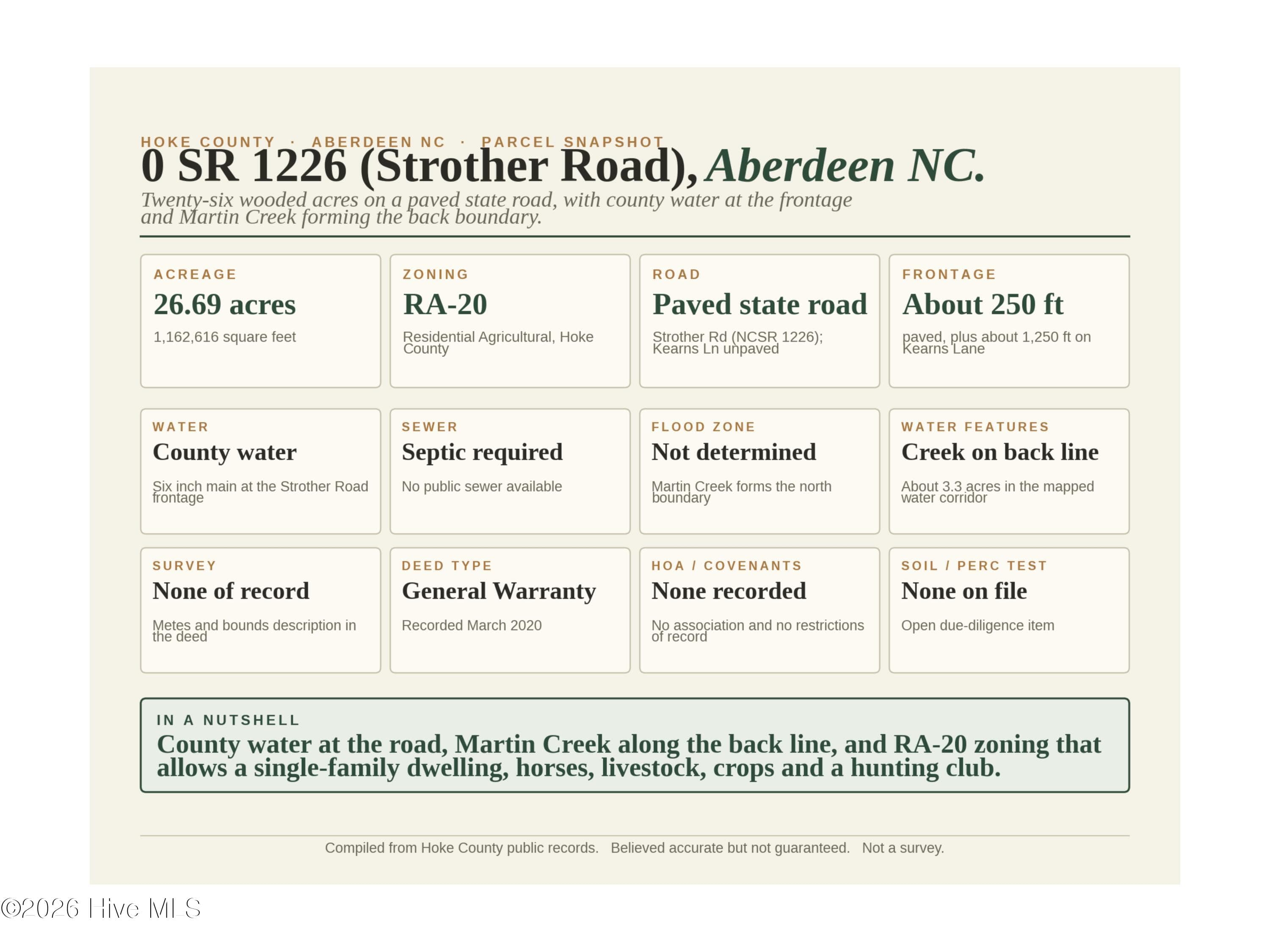
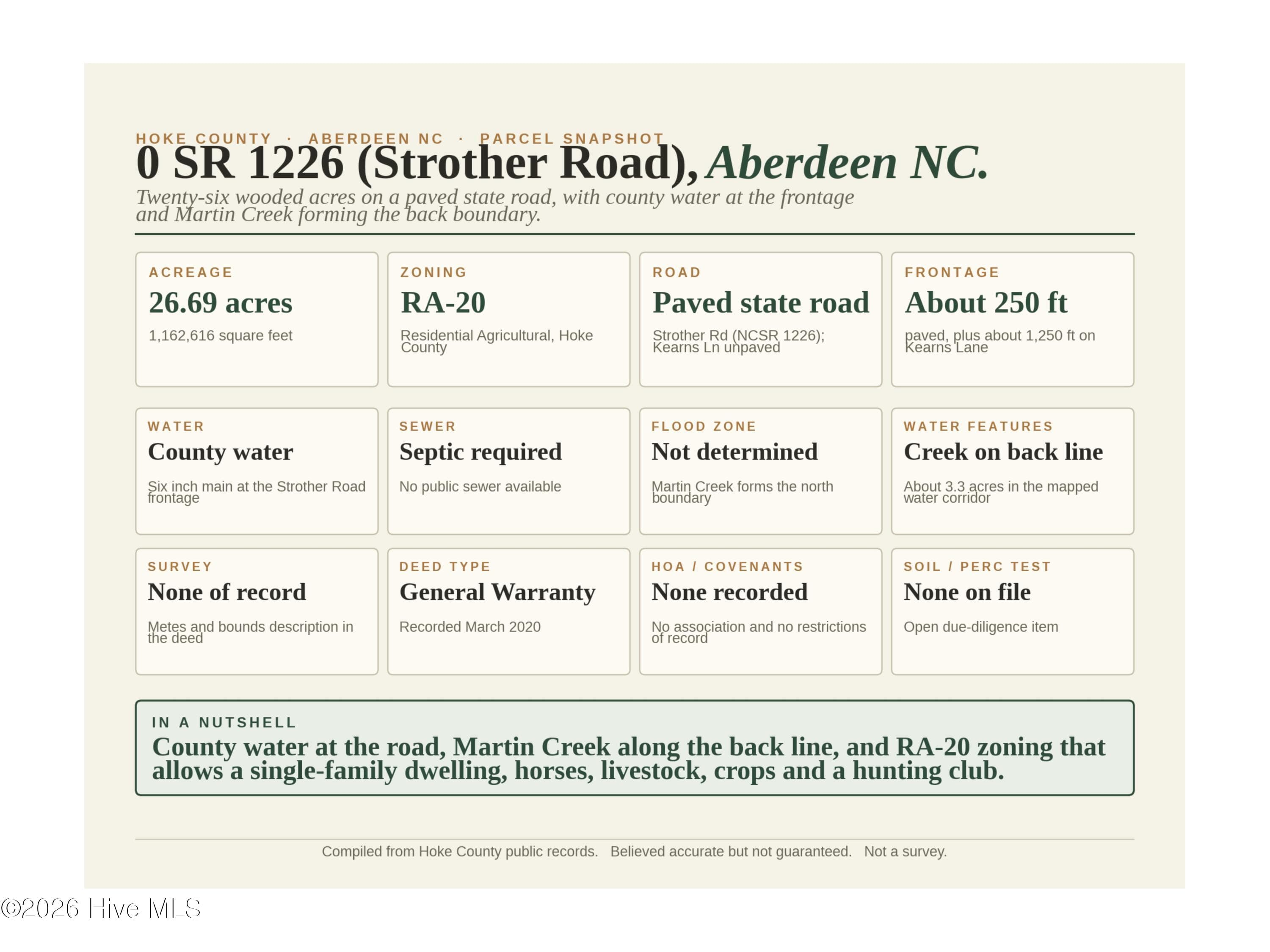
Parcel Facts - 26.69 Acres Hoke County NC - Zoning Water Access - 00-00 Strother Road, Aberdeen, NC 28315
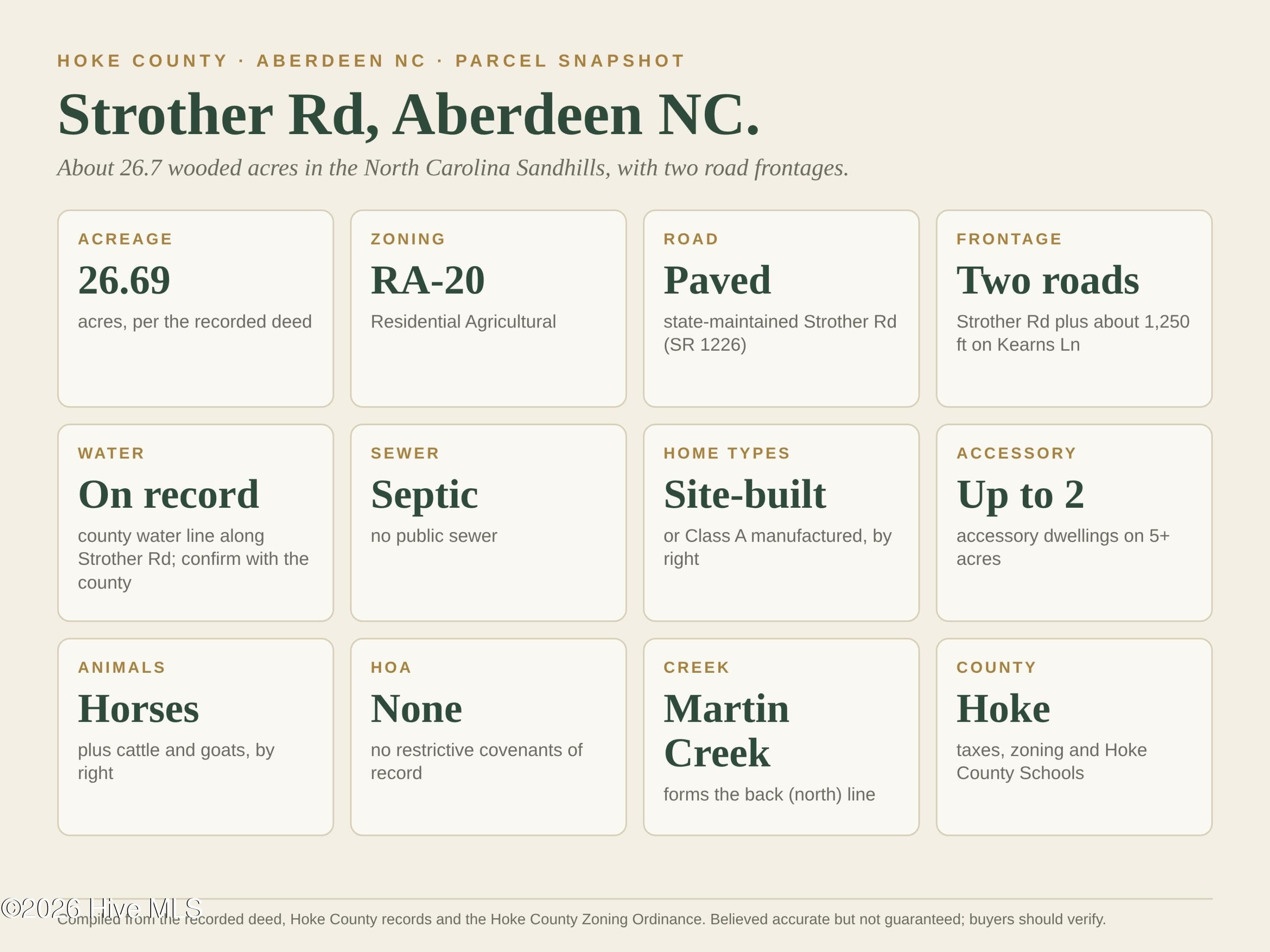
Quick facts: 26.69 acres, RA-20 zoning, paved Strother Rd plus Kearns Ln frontage, county water line on record, septic needed, no HOA. Compiled from county records; buyers should verify. - 00-00 Strother Road, Aberdeen, NC 28315
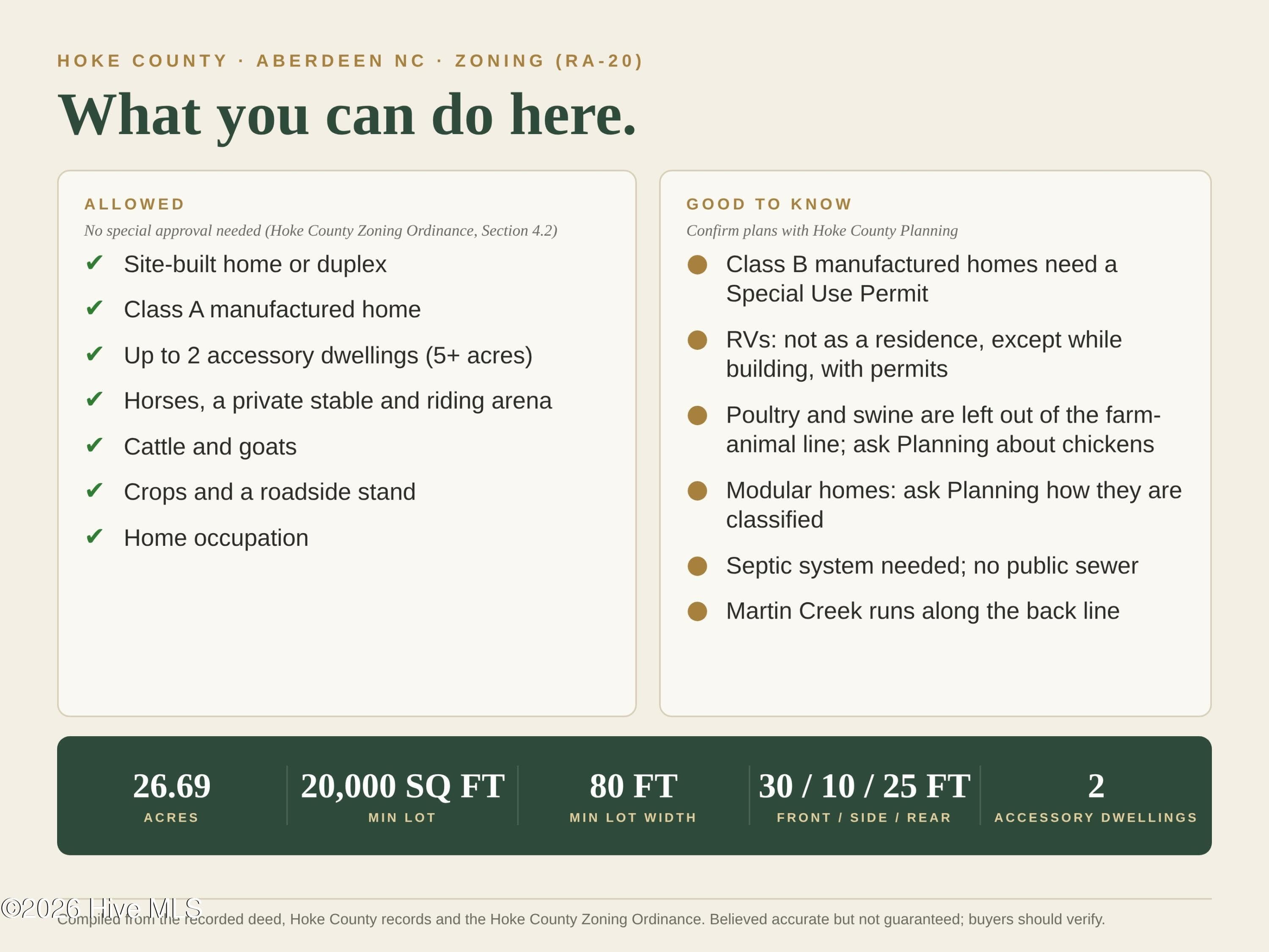
Parcel Facts - 26.69 Acres Hoke County NC - Zoning Water Access - 00-00 Strother Road, Aberdeen, NC 28315
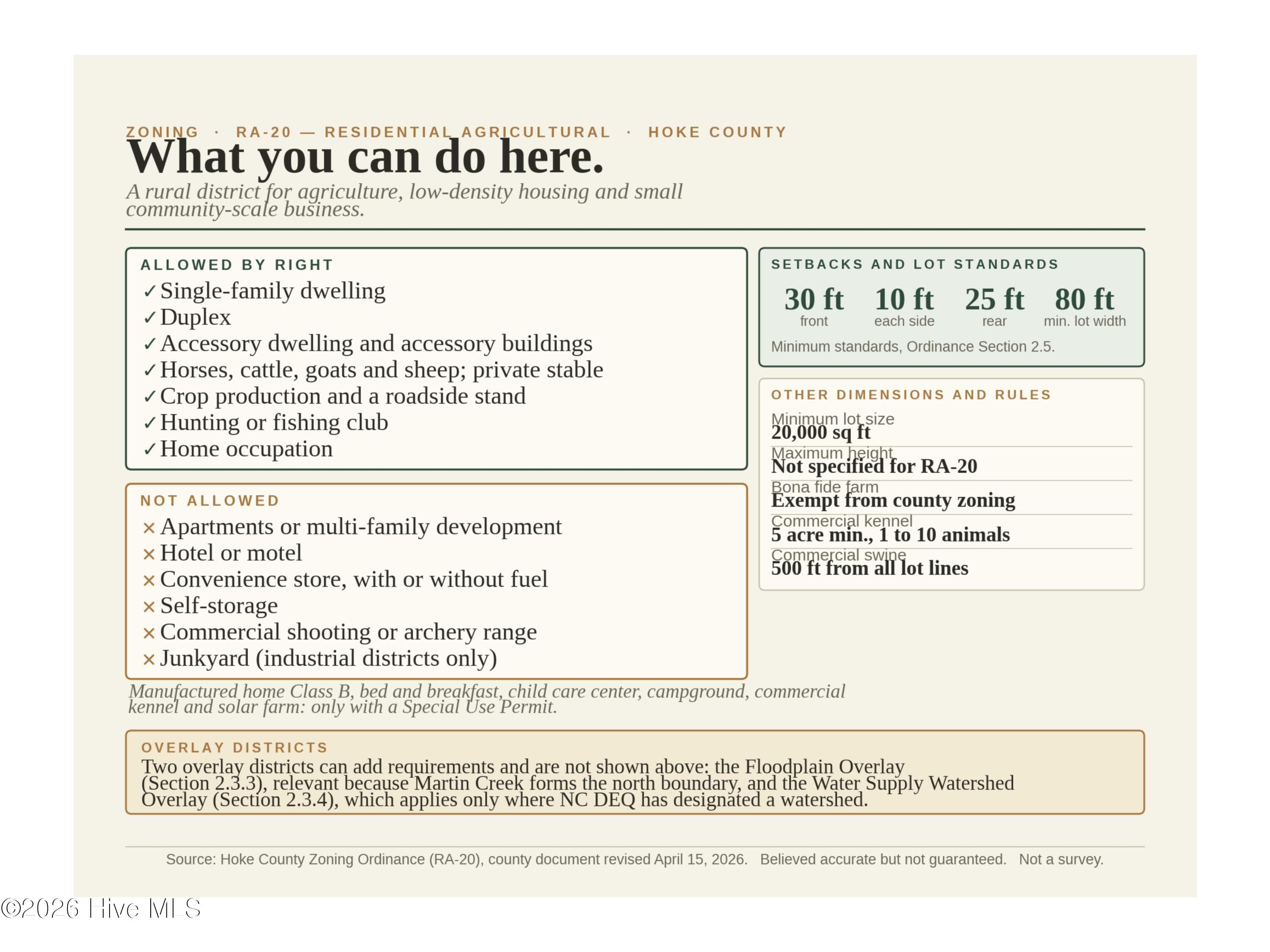
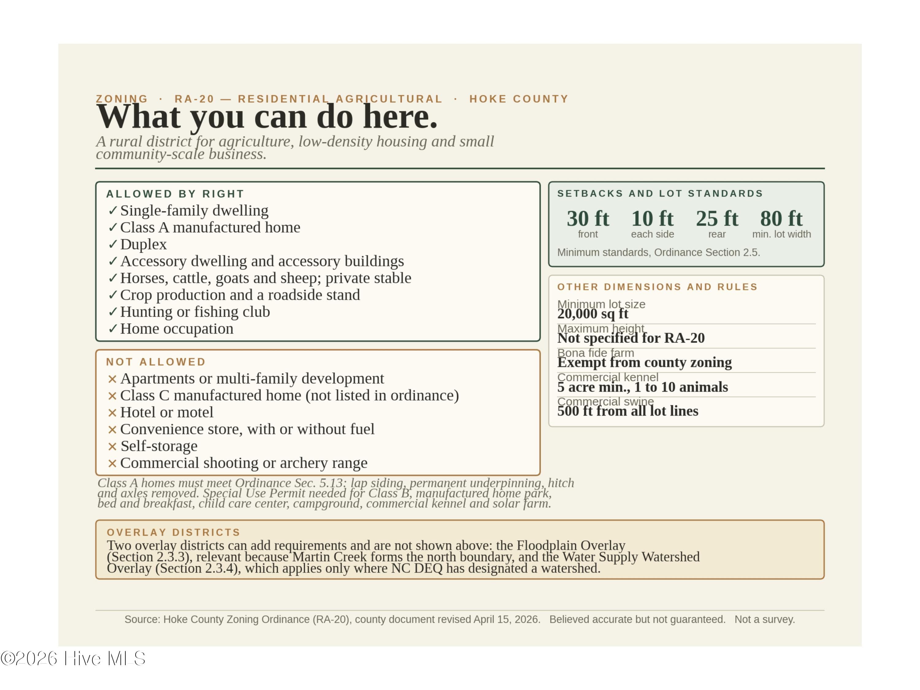
Site-built or Class A manufactured home, up to 2 accessory dwellings, horses, cattle and goats, crops and a roadside stand, all allowed by right under Hoke County RA-20 zoning. - 00-00 Strother Road, Aberdeen, NC 28315
RA-20 Zoning - Homes, Horses, Livestock and Hunting Allowed - 00-00 Strother Road, Aberdeen, NC 28315
Agriculture at 00-00 Strother Road, Aberdeen, NC 28315, photo 13 of 31
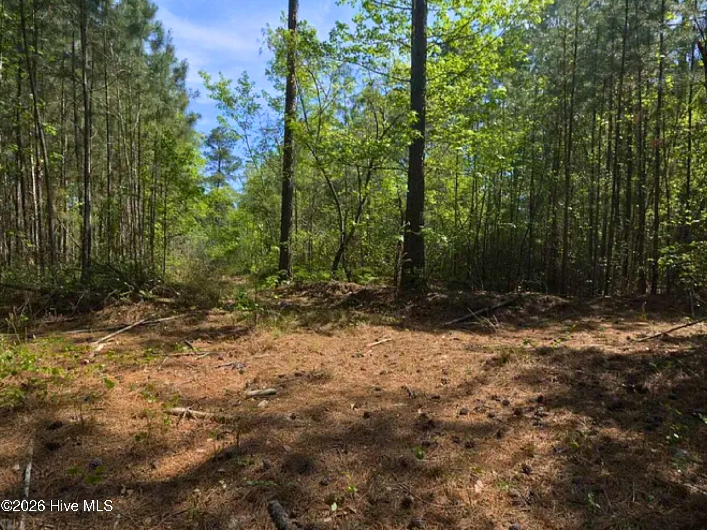
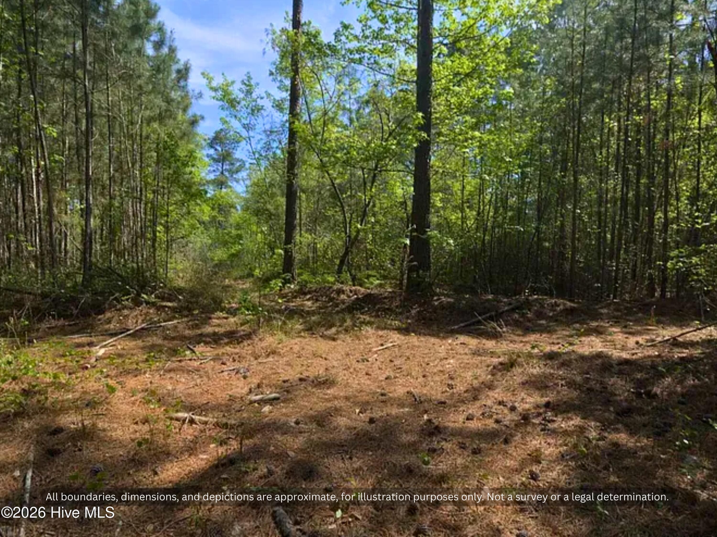
Pines and hardwoods seen from Kearns Ln on the south side of the land. Quiet wooded country property in Hoke County, NC for a home, cabin or weekend retreat. - 00-00 Strother Road, Aberdeen, NC 28315
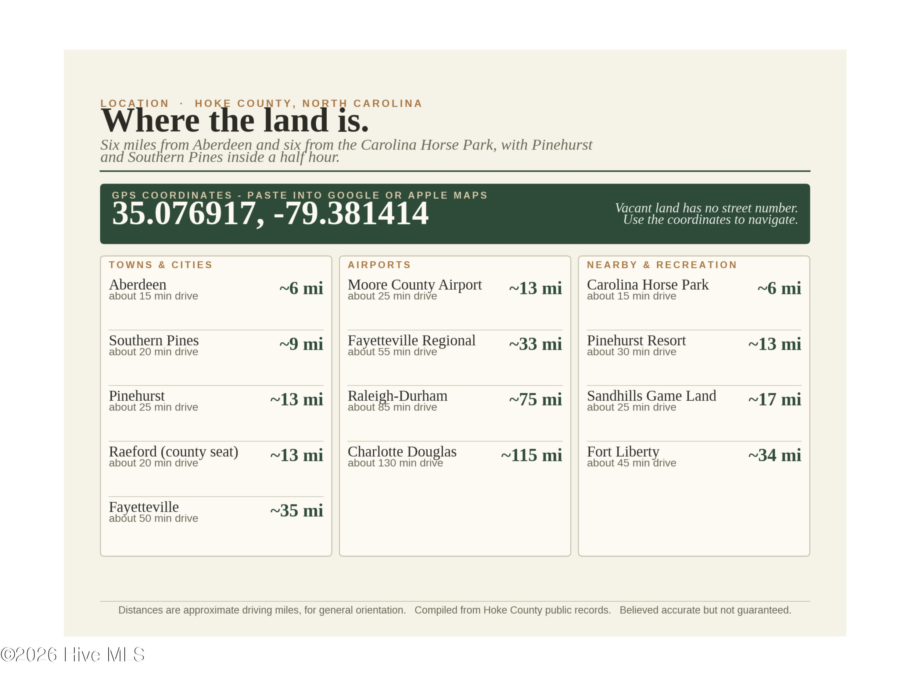
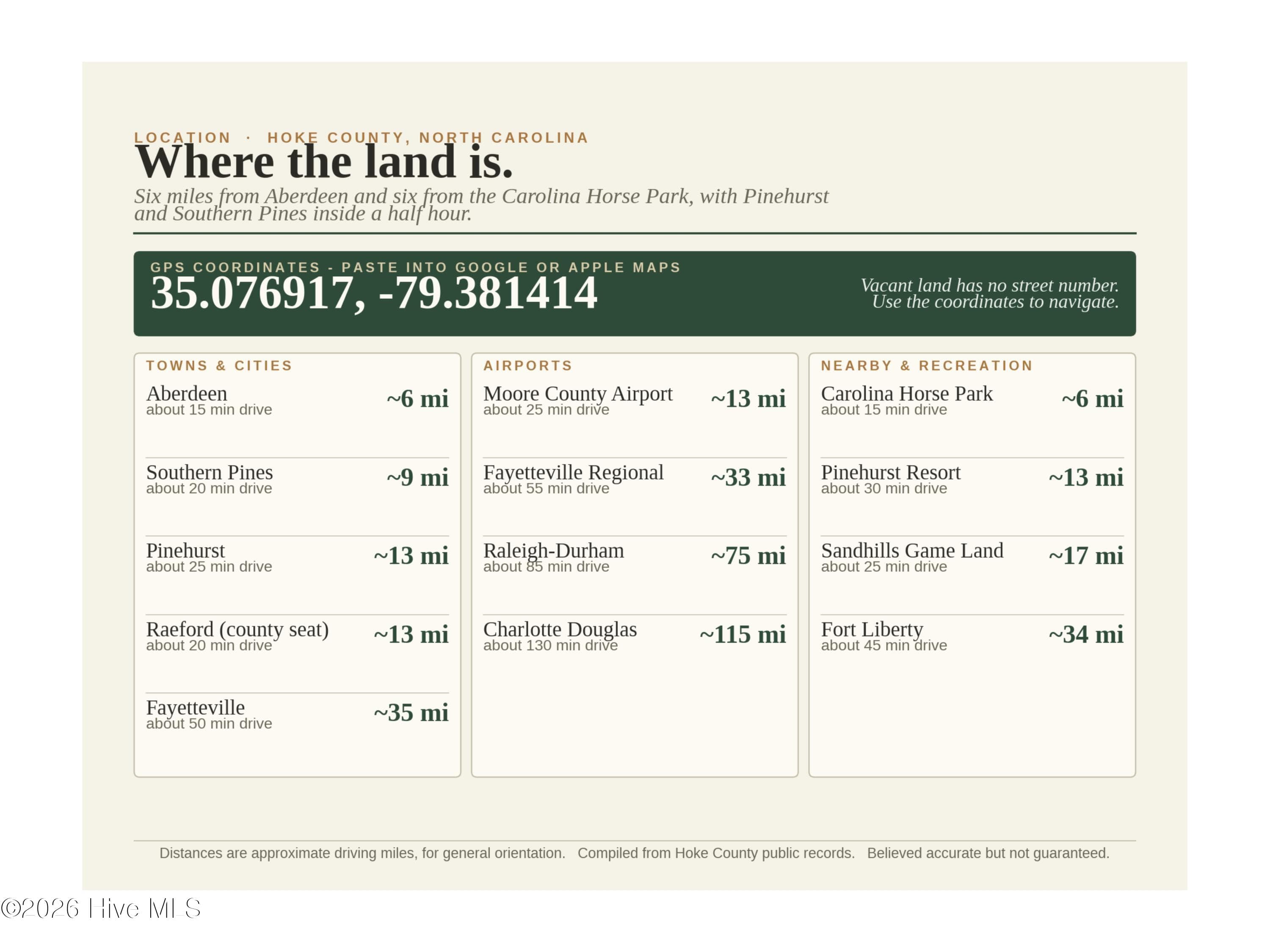
Location Map - 6 Mi to Aberdeen, 13 Mi to Pinehurst NC - 00-00 Strother Road, Aberdeen, NC 28315
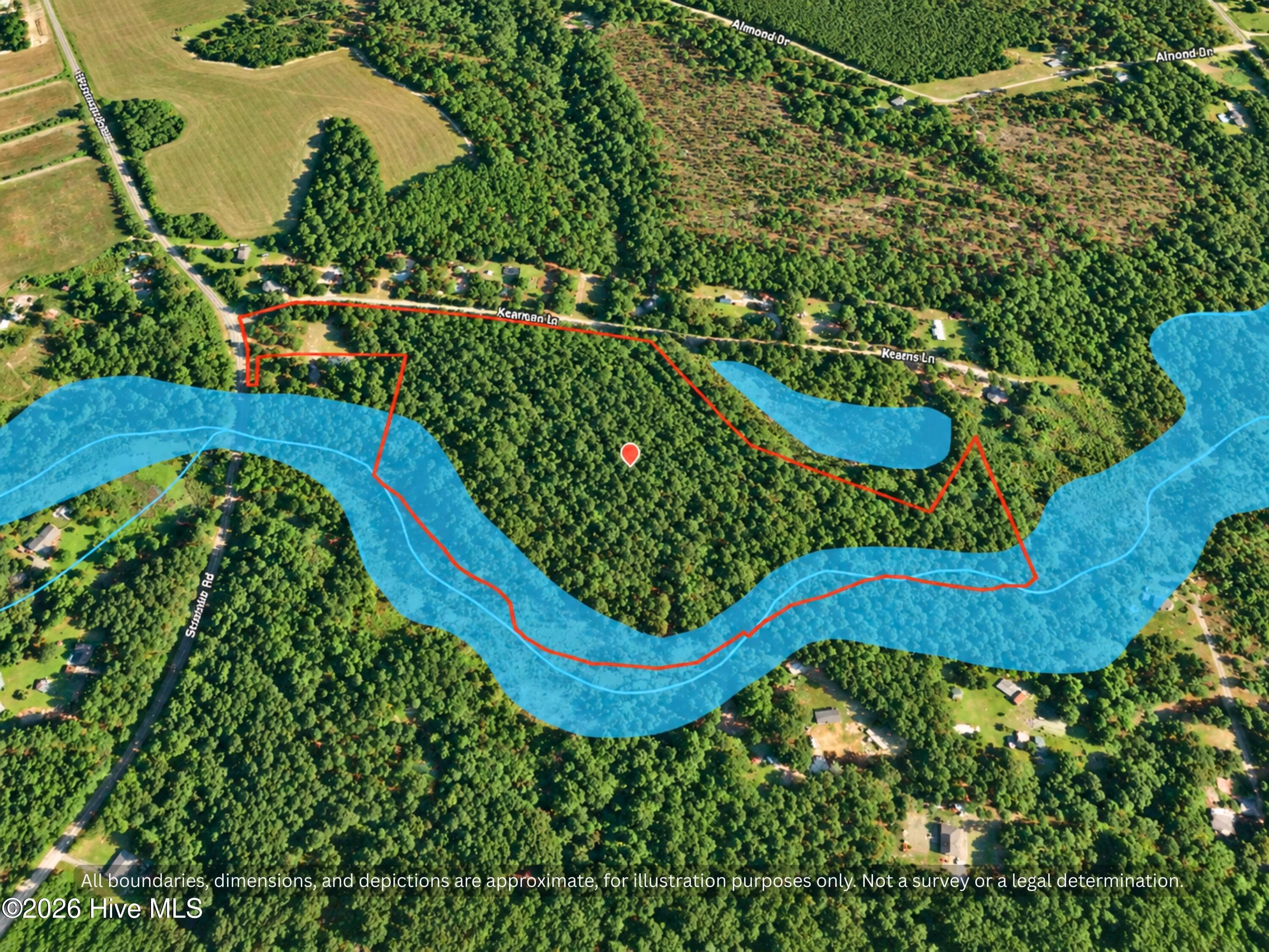
3D aerial from the Kearns Ln side showing the approximate boundary among woods and country homes in Hoke County, NC. The pond shown is on the neighboring lot. Image enhanced for clarity. - 00-00 Strother Road, Aberdeen, NC 28315
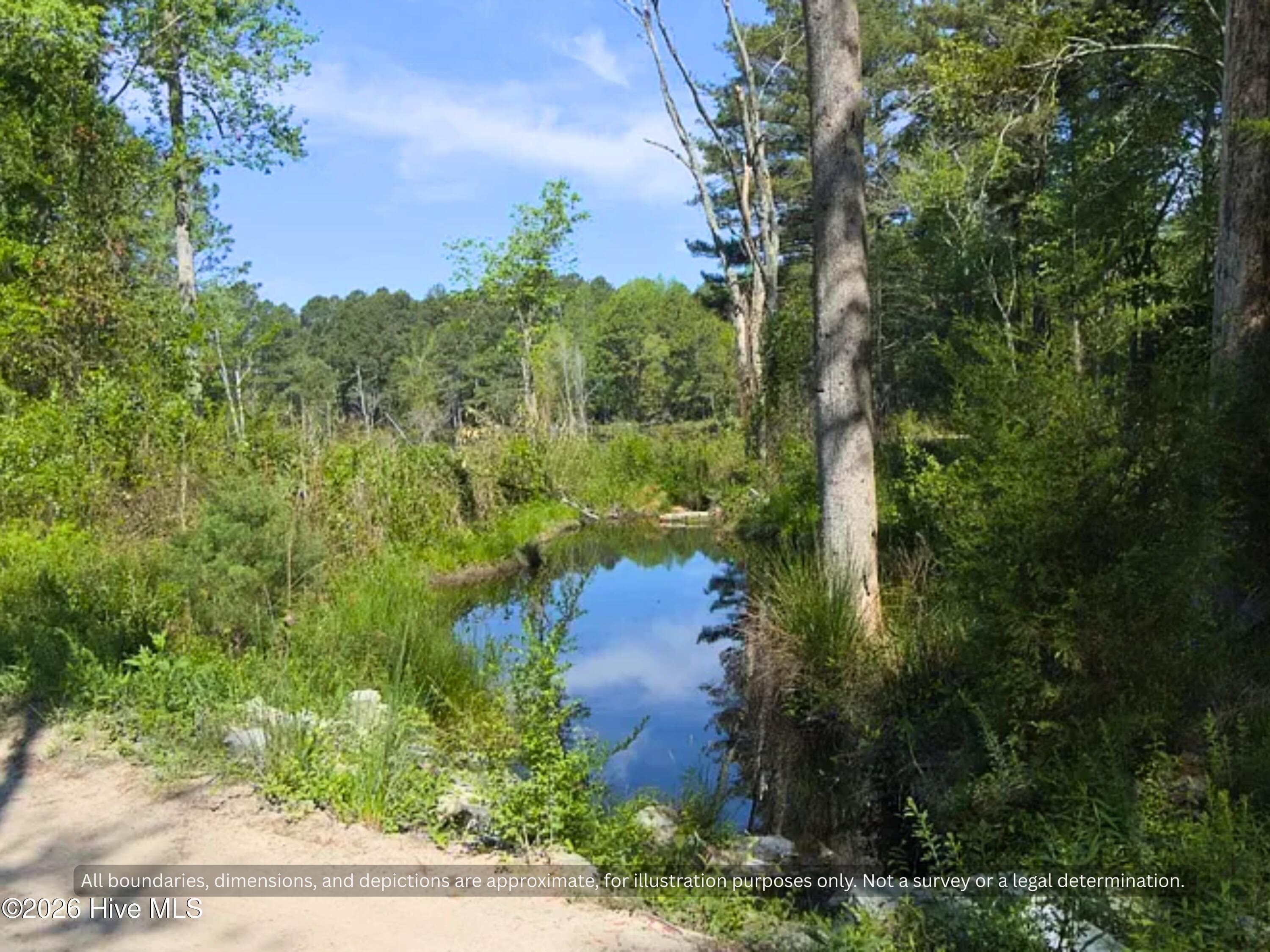
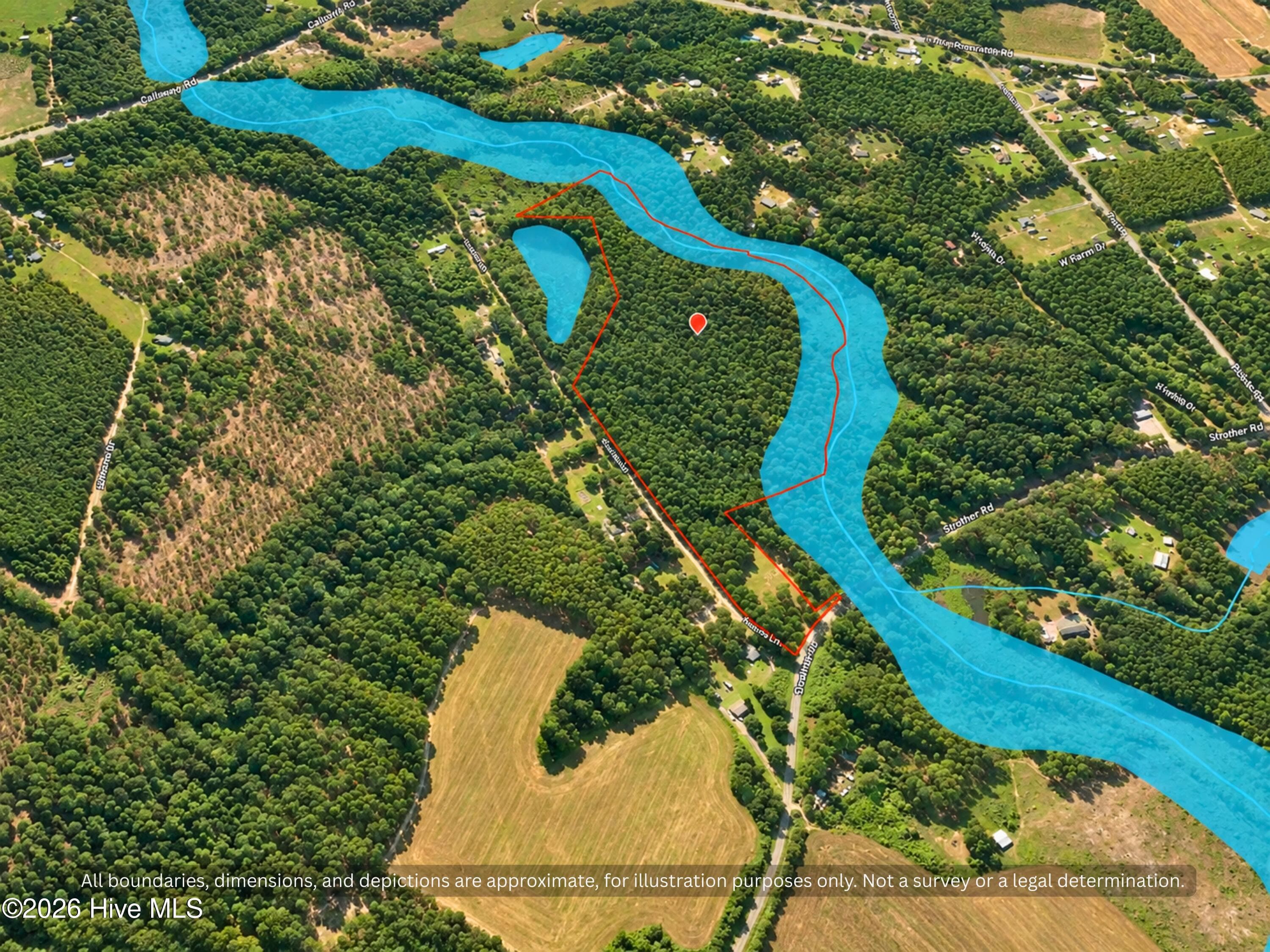
Martin Creek at Rear Boundary - Creek Front Land Hoke County NC - 00-00 Strother Road, Aberdeen, NC 28315
Overhead aerial of the approximate parcel lines between Strother Rd and Kearns Ln, with Martin Creek along the back line. About 12 miles to Raeford. Boundary approximate. Image enhanced for clarity. - 00-00 Strother Road, Aberdeen, NC 28315
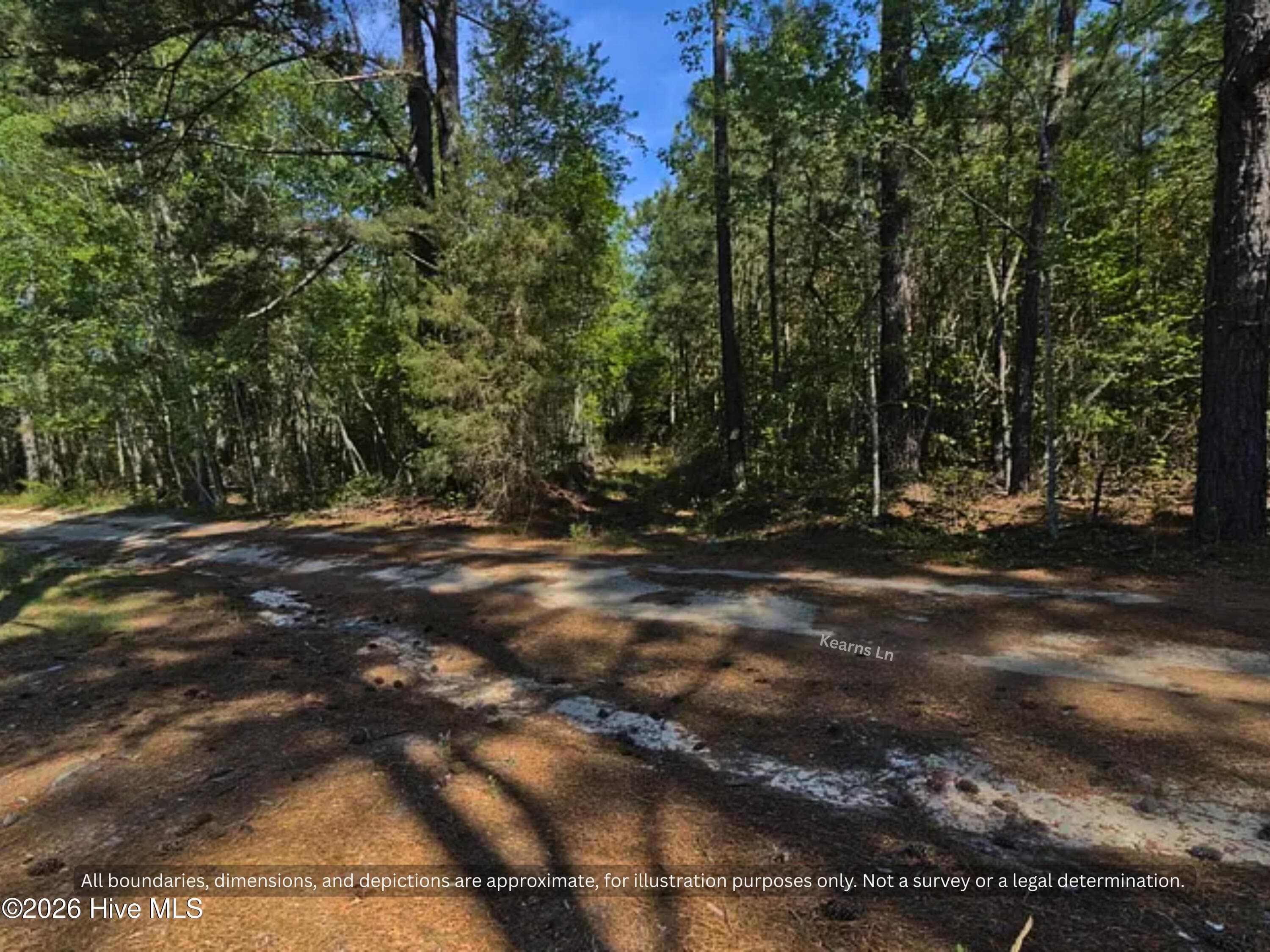
Wooded Acreage - Hunting Land for Sale Sandhills NC - No HOA - 00-00 Strother Road, Aberdeen, NC 28315
Ground view along unpaved Kearns Ln, which runs about 1,250 ft along the south line of the land. Mature pines and hardwoods in rural Hoke County, NC. - 00-00 Strother Road, Aberdeen, NC 28315
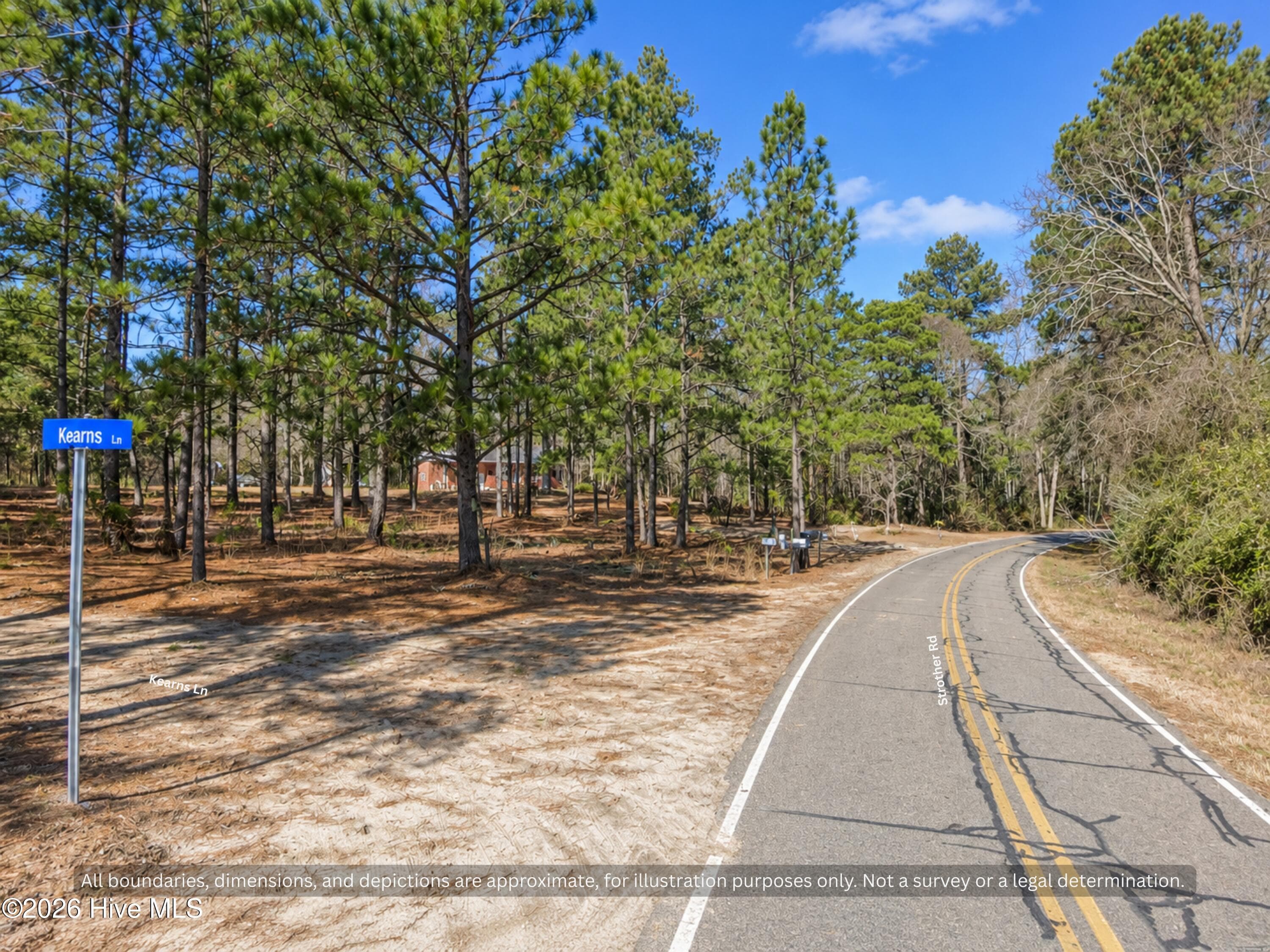
Paved State Road Frontage - Strother Road SR 1226 - Aberdeen NC - 00-00 Strother Road, Aberdeen, NC 28315
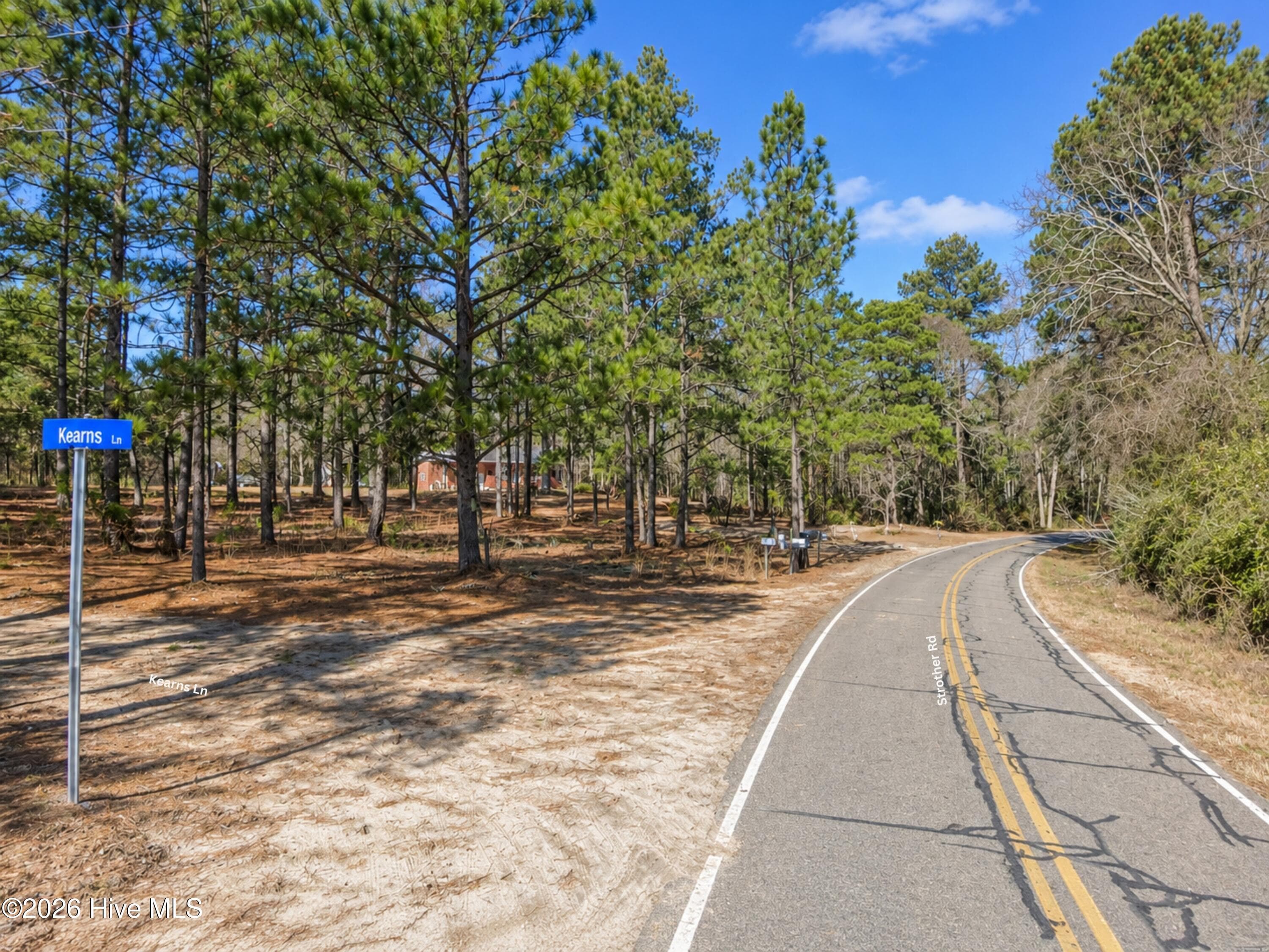
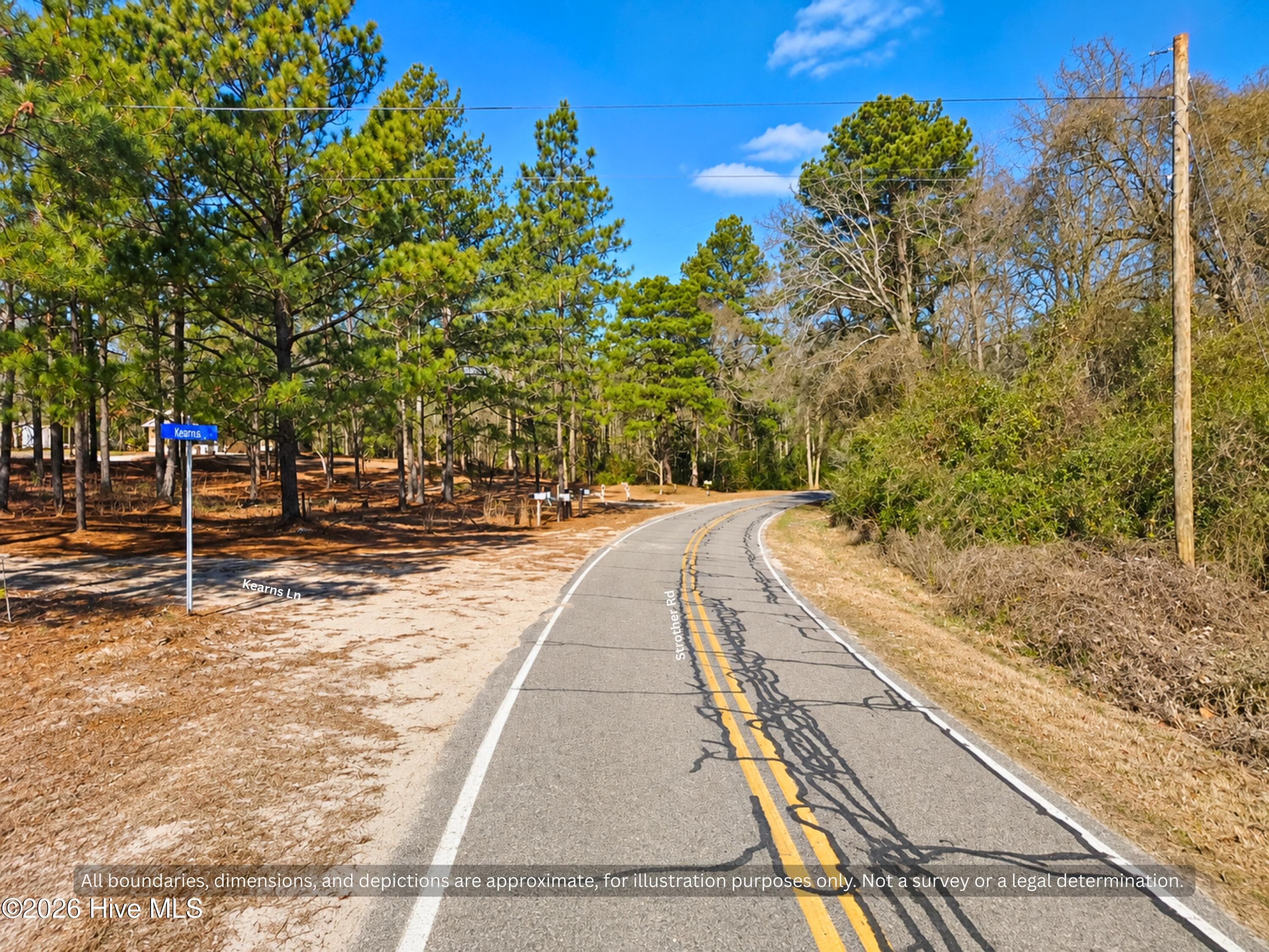
Kearns Ln street sign at paved Strother Rd, the turn to the long side of the land. Wooded country acreage near Aberdeen and Raeford, NC. - 00-00 Strother Road, Aberdeen, NC 28315
Second Road Frontage on Kearns Lane - 26 Acres Hoke County NC - 00-00 Strother Road, Aberdeen, NC 28315
Agriculture at 00-00 Strother Road, Aberdeen, NC 28315, photo 24 of 31
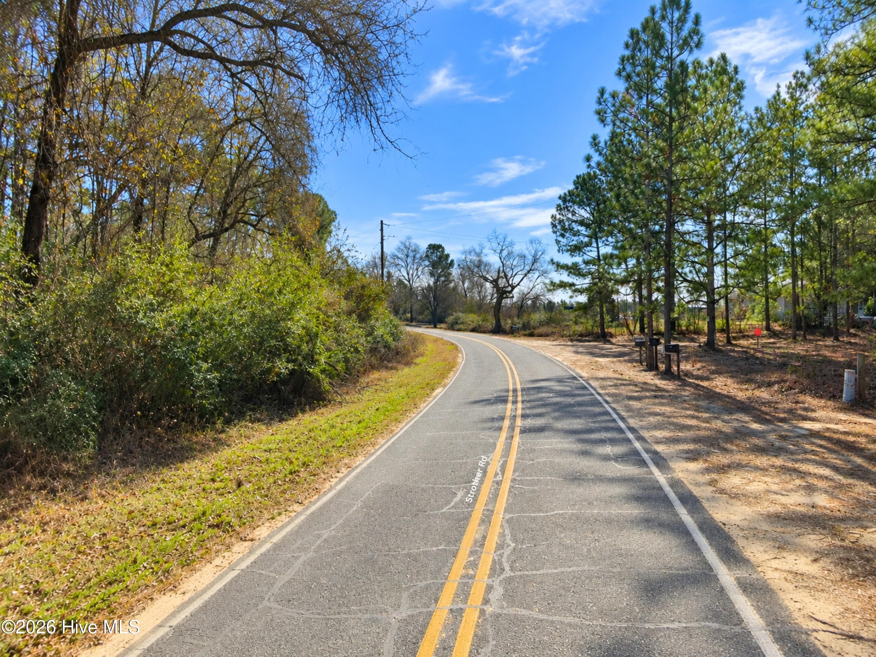
Paved, state-maintained Strother Rd leading to the land, with power poles along the road. No long dirt drive to reach this Hoke County, NC acreage. - 00-00 Strother Road, Aberdeen, NC 28315
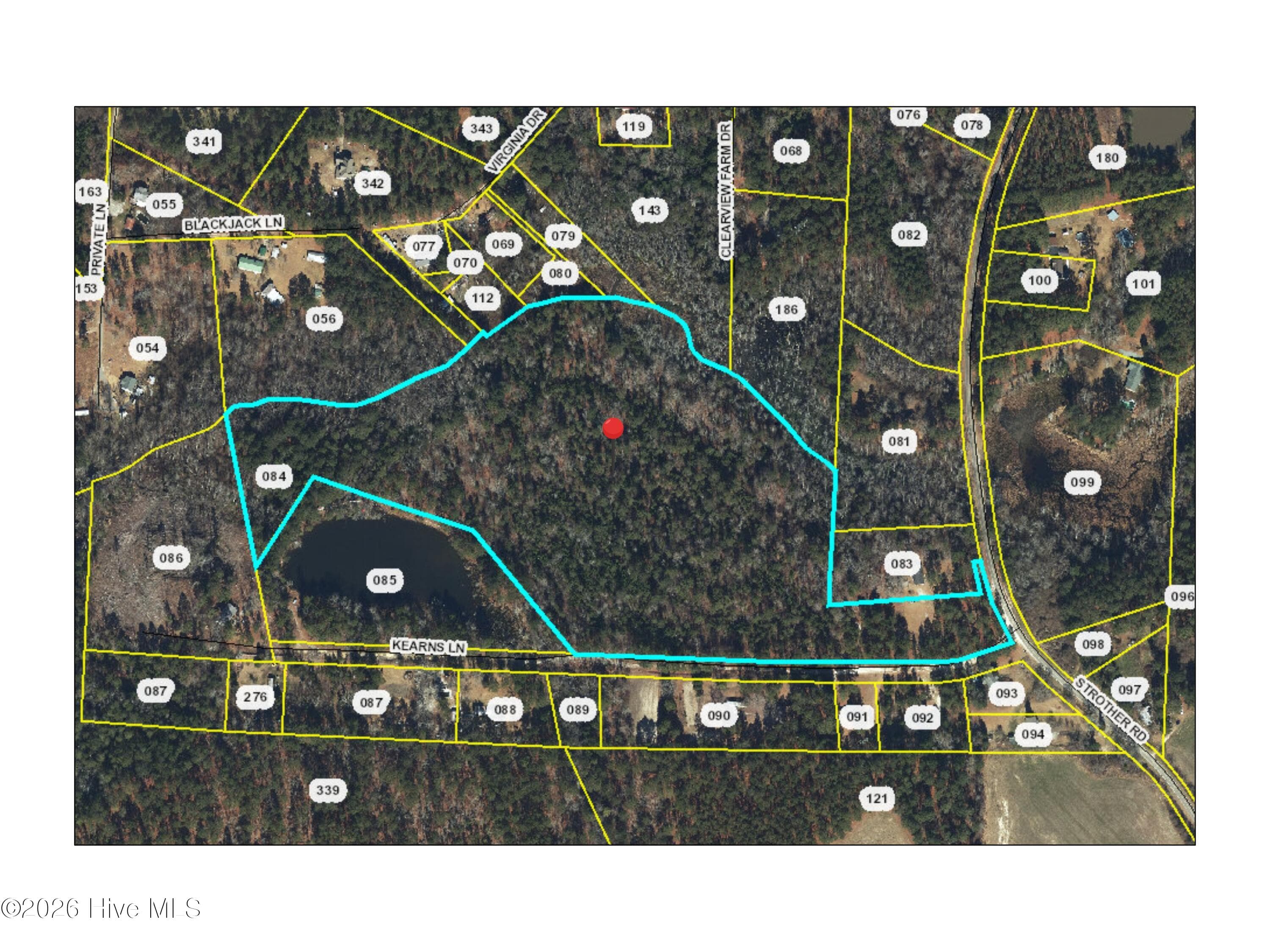
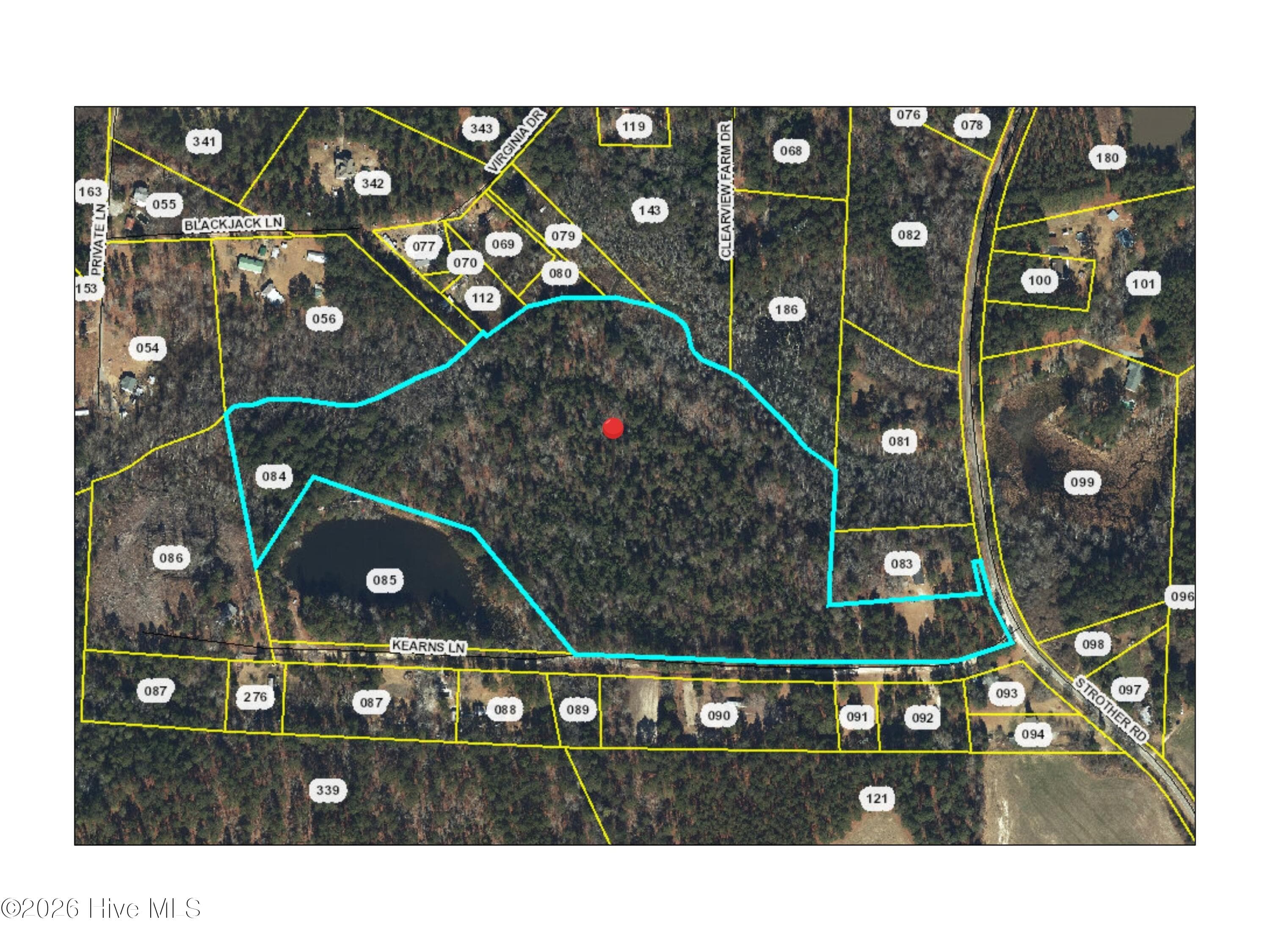
County GIS map of the parcel outline between Strother Rd and Kearns Ln. The pond on the map is on the neighboring parcel, not this land. Lines approximate; buyers should verify. - 00-00 Strother Road, Aberdeen, NC 28315
Agriculture at 00-00 Strother Road, Aberdeen, NC 28315, photo 27 of 31
Agriculture at 00-00 Strother Road, Aberdeen, NC 28315, photo 28 of 31
Agriculture at 00-00 Strother Road, Aberdeen, NC 28315, photo 29 of 31
Land Near Fort Liberty and Pinehurst NC - 26 Acres Hoke County - 00-00 Strother Road, Aberdeen, NC 28315
Agriculture at 00-00 Strother Road, Aberdeen, NC 28315, photo 31 of 31
31 photos

$239,900

00-00 Strother Road, Aberdeen, NC 28315
Aberdeen, NC 28315
Listed by Kamaria Walker · Dalton Wade, Inc.
Bedrooms
N/A
Bathrooms
N/A
Living area
N/A
Year built
N/A

About this home

26 ACRES HOKE COUNTY NC - NO HOA - COUNTY WATER AT ROAD - MANUFACTURED HOMES OK 26.69 acres in Hoke County, about six miles from Aberdeen and six miles from the Carolina Horse Park, zoned RA-20 Residential Agricultural. County water is already at the road. Septic system is required (soil testing required) The tract has two road frontages. About 250 feet fronts Strother Road (State Road 1226), which is paved and state maintained. The balance, roughly 1,250 feet, fronts Kearns Lane, an unpaved road running west that serves several neighboring tracts. Martin Creek forms the rear boundary. The recorded deed runs with the creek, and county mapping shows a water corridor along that line covering roughly 3.3 acres, about 12 percent of the tract. No HOA, no association dues, and no restrictive covenants of record. RA-20 is one of the more permissive rural districts in Hoke County. Permitted by right: single-family dwelling, duplex, accessory dwelling, Class A manufactured home, home occupation, crop production, private stable, equestrian boarding and riding arenas, animal production excluding swine and poultry, game preserve, and a hunting or fishing club. Bona fide farm use is exempt from county zoning under state law. Setbacks are 30 feet front, 10 feet each side, 25 feet rear, on a 20,000 square foot minimum lot. Distances by road: Aberdeen about 6 miles, Carolina Horse Park about 6 miles, Southern Pines about 9 miles, Pinehurst about 13 miles, Moore County Airport about 13 miles, Raeford about 13 miles, Sandhills Game Land about 17 miles, Fayetteville Regional Airport about 33 miles, Fort Liberty about 34 miles. Doorify MLS # 10191802 Hive MLS #: 100602388 LongLeaf MLS #: 769142

Property details

MLS
Hive MLS
MLS #
100602388
Property type
Agriculture
Subdivision
Not In Subdivision
Status
Active
Days on market
41
On market date
September 9, 2026
Stories
N/A
Total bathrooms
N/A
Garage spaces
N/A
Parking spaces
N/A
Lot size
26.69 acres
Loading map…

Nearby schools

Within 10 miles. School directory data from the National Center for Education Statistics (NCES), accessed via the Urban Institute Education Data API. Local Score is calculated by INNOVATE Real Estate; where a state rating is shown, it comes from that state's own official school report card.

Elementary
West Hoke Elementary
7.7 mi away · Grades -1-5
Zoned school (attendance boundary, 2015-16 data)
2.6
Local Score (state rating (2025) blended 70/30 with student-teacher ratio) -- not an official state rating
State rating: D (2025)
Enrollment
501
Student:teacher ratio
14.7:1
District
Hoke County Schools
Middle
West Hoke Middle
9.62 mi away · Grades 6-8
Zoned school (attendance boundary, 2015-16 data)
2.6
Local Score (state rating (2025) blended 70/30 with student-teacher ratio) -- not an official state rating
State rating: D (2025)
Enrollment
570
Student:teacher ratio
13.6:1
District
Hoke County Schools
High
Hoke County High
10.81 mi away · Grades 9-12
Zoned school (attendance boundary, 2015-16 data)
3.0
Local Score (state rating (2025) blended 70/30 with student-teacher ratio) -- not an official state rating
State rating: C (2025)
Enrollment
1,988
Student:teacher ratio
15.9:1
District
Hoke County Schools

Walkability

Blended score for Aberdeen's center, calculated by INNOVATE Real Estate from two sources: the EPA's National Walkability Index (street network, transit, land-use mix) and Google Places amenity data (what's actually reachable on foot from this point). 60% EPA National Walkability Index + 40% nearby-amenity density (Google Places).

14
Very car-dependent
out of 100
EPA National Walkability Index
4.5 / 20 -- Least walkable
Google Places amenity density
0 / 100
Restaurants & cafes0
Grocery stores0
Parks0
Schools0
Transit stops0
Pharmacies0

Mortgage calculator

Estimate only - actual rate and payment depend on your lender, credit, and loan program.

$
%
%
Adjust tax / insurance estimates
% / yr
$
/mo
Est. monthly payment
$1,595/mo
$47,980 down
$191,920 loan
Principal & interest$1,245
Property tax (est.)$200
Home insurance (est.)$150

Similar homes you might like

Data source: Listing information provided by Hive MLS via Trestle/CoreLogic. Last updated 2 days ago.

Information herein deemed reliable but not guaranteed; all measurements, school assignments, HOA fees, taxes, and feature lists are approximate and should be independently verified. Equal Housing Opportunity.