


$1,171,850
About this home
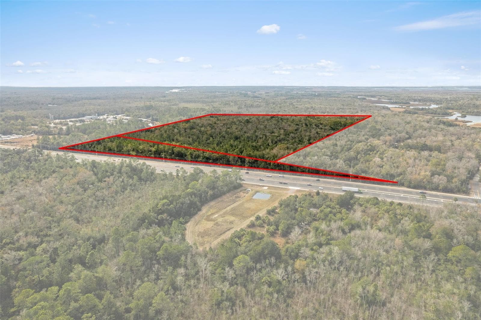
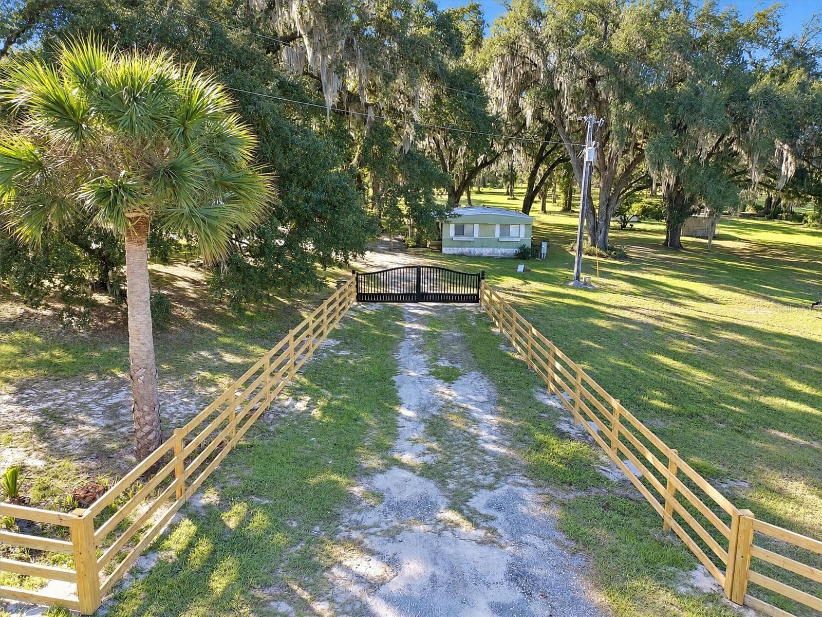
Positioned along busy US Hwy 19/98 in Homosassa, this 49.23± acre development opportunity offers over 1,800 feet of highway frontage and exposure to approximately 21,500 vehicles per day, delivering exceptional visibility and access within one of Citrus County’s most active commercial corridors. The property features a flexible mixed-zoning configuration suited for phased development and long-term value creation. Approximately 8.72± acres are zoned General Neighborhood Commercial (GNC), permitting a wide range of uses including retail, medical and professional office, automotive sales and service, restaurants, and service-oriented businesses, with multifamily development possible at up to 10 units per acre through a Planned Unit Development (PUD) and utility connections meeting Land Development Code requirements. The remaining 40.51± acres are zoned LDR (Low Density Residential), allowing a base density of two dwelling units per acre with the potential to increase density up to six units per acre through a PUD. Permitted residential configurations include single-family, duplex, and attached housing, while conditional uses may include assisted living facilities, nursing homes, and certain recreational uses subject to approval. Based on available GIS mapping and environmental data, the parcel is generally characterized as approximately 4.93 acres of GNC commercial uplands, 3.84 acres of GNC wetlands, 34.74 acres of LDR uplands, and 5.77 acres of LDR wetlands. Using the upland residential acreage of 34.74 acres, the site could support an estimated 69 dwelling units at the base density of two units per acre, approximately 139 units at a realistic planning yield of four units per acre, or up to 208 units at the maximum six units per acre with PUD approval and compliance with infrastructure and utility requirements. The 4.93 acres of commercial uplands provide capacity for approximately 43,000 to 64,000 square feet of neighborhood retail, medical, or service-oriented commercial development, depending on site design and coverage ratios. If wetland areas are mitigated and deemed developable, additional density may be achievable; however, all density figures are planning estimates only and subject to formal wetland delineation, engineering analysis, mitigation requirements, and jurisdictional approvals. The site is located within an established retail node supported by national grocers, retailers, quick-service restaurants, fuel stations, and service providers that create consistent consumer draw and sustained commercial demand. Regional connectivity is enhanced by direct access to US Hwy 19/98 and proximity to the expanded Suncoast Parkway (SR 589), a $135 million state infrastructure investment that improves regional mobility and places the property within approximately 55 minutes of Tampa International Airport.
Property details
- MLS
- Stellar MLS
- MLS #
- MFROM718460
- Property type
- Land
- Subdivision
- STONEWOOD UNREC
- Status
- Active
- Days on market
- 188
- On market date
- February 13, 2026
- Stories
- N/A
- Total bathrooms
- N/A
- Garage spaces
- N/A
- Parking spaces
- N/A
- Lot size
- 49.23 acres
Location
Get directions →Nearby schools
Within 10 miles. School directory data from the National Center for Education Statistics (NCES), accessed via the Urban Institute Education Data API. Local Score is calculated by INNOVATE Real Estate; where a state rating is shown, it comes from that state's own official school report card.
- Enrollment
- 642
- Student:teacher ratio
- 14.9:1
- District
- CITRUS
- Enrollment
- 810
- Student:teacher ratio
- 16.5:1
- District
- CITRUS
- Enrollment
- 1,634
- Student:teacher ratio
- 19.2:1
- District
- CITRUS
Walkability
Blended score for HOMOSASSA's center, calculated by INNOVATE Real Estate from two sources: the EPA's National Walkability Index (street network, transit, land-use mix) and Google Places amenity data (what's actually reachable on foot from this point). 60% EPA National Walkability Index + 40% nearby-amenity density (Google Places).
Market position
How this listing compares to current activity in HOMOSASSA, from live MLS data.
Mortgage calculator
Estimate only - actual rate and payment depend on your lender, credit, and loan program.
Adjust tax / insurance estimates
Similar homes you might like
Data source: Listing information provided by Stellar MLS (mfrmls) via Trestle/CoreLogic. Last updated August 20, 2026.
Information herein deemed reliable but not guaranteed; all measurements, school assignments, HOA fees, taxes, and feature lists are approximate and should be independently verified. Equal Housing Opportunity.